
The day had finally arrived when I would do my final coastal walk in Scotland and I knew it would be a tough one.
The overnight rest at my B&B in Berwick had certainly done the trick, my legs felt ok and I felt confident of taking on another gruelling day. I decided to make a very early start as the forecast was for a bright sunny day and I wanted to get some of the walk done before the sun was high in the sky. I parked my car at a small car park, just up from the pier in Berwick-upon-Tweed and then walked back into Berwick and headed for the railway station. I caught the 05:30 #253 bus to Cockburnspath. This service is run by Borders Buses, an offshoot from the West Coast Motors bus company across in Argyll. With their distinctive livery I thought they provided an excellent service and where probably my favourite carrier to date. I chatted to the driver before we departed, he was from Berwick, and was complaining that the Government had just put most of the NE of England, from Northumberland down to Teesside into local lockdown, due to a surge in Covid-19 cases. I was therefore quite lucky, in that, I would not have been allowed to travel and walk in the area later that day.
I got off the bus in Cockburnspath and it was still quite dark. Cockburnspath is a sort of path terminus for the start/end of the Southern Upland Way, the John Muir Way Link and the Berwickshire Coastal Path which I would be following off and on throughout the day. For the next couple of miles I was still using my head torch as I headed down to the large leisure/holiday homes complex at Pease Bay.
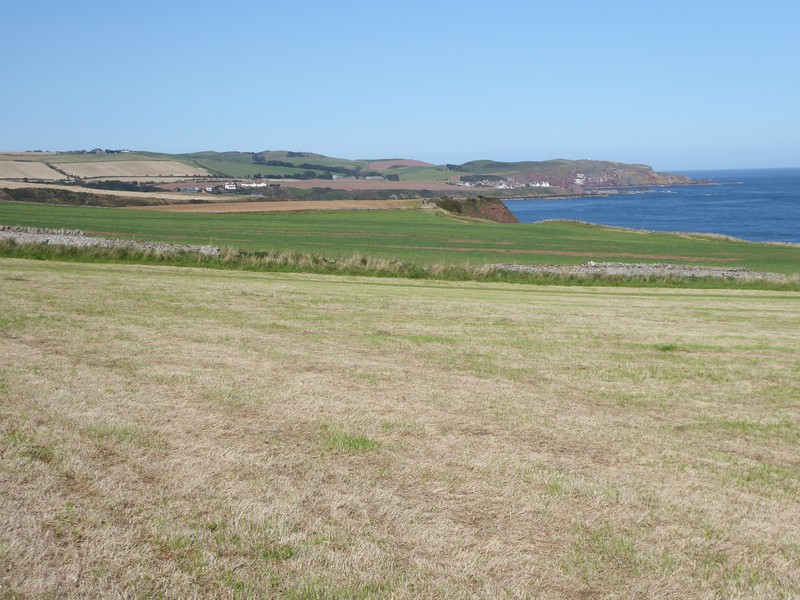
The climb up out of Pease Bay was very steep and because of the tight narrow road a wooden flight of stands was provided for pedestrians. I chose to walk along the road instead. I was heading for the old coast road which ran along much higher ground and provided the best views up and down the coastline. Far below me was Siccar Point, famous in geological terms for the site of Hutton’ s Unconformity, it was a long way down and a long way back up, so I carried on. I passed though the old hamlets of Old Cambus West & East Mains, then through Redheugh Farm where I gradually gained height south eastwards to the much higher ground of Harly Darlies at 230m. Here I picked up the Dowlaw Road, which ran towards the Dowlaw Farm. Dowlaw Farm offered camping for £15 per night, but I’m not sure what you actually got for your money as they called the payment a “donation”.
The walking after Dowlaw Farm was hilly sheep and cattle country, but the going was easy and up until now my legs felt ok. After passing some Admiralty Distance Poles, apparently used to measures nautical miles, the cliffs began to gain some serious height. When I came to Waterside Dean I descended steeply into a huge gully and then had to climb back up to 161m. It was quite a test on my legs and with the heat was tough going.


I was now able to look down on St Abbs Head, which was a lot lower than the ground I was on. The walk down to and then up onto St Abbs Head was not too bad. I was rewarded with great views both north and south along the Berwickshire Coast. As I descended towards the small fishing village of St. Abbs I met more walkers who were heading up to St Abbs Head. The red sandstone cliffs in the area were very impressive and with the path exposed, a trip could easily have dire consequences. I did not descend down to the harbour in St Abbs, as even small descents and consequential re-ascents is something that my mind is telling me not to do. I did pop into the tiny village Post Office where I bought more drinks to keep me going. However, between St Abbs and my next destination – Eyemouth there were numerous descents down to the beach and back up the cliff, which were becoming painful.
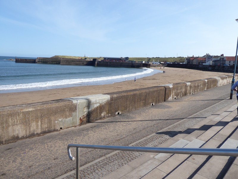
Eventually I came into the larger town of Eyemouth, which was quite busy. I popped into a co-op to buy further drinks, even though I was carrying plenty of water still. I have developed a taste for those iced coffee drinks, which tend to distract or take my mind off the complaining what my body is trying to tell me!
When I reached the village of Burnmouth I was joined by the main East Coast Rail line, this was quite important, as it marked the final section of the walk where the railway line, the A1 road and the coastal path were ‘pinched’ tightly together between the sea and the higher ground. I crossed under the railway line for the final time. As I passed Hilton Bay I saw a sign for a bothy down the cliffs towards the beach. I had a quick look but could only see the ruins of a cottage. At Marshall Meadows I passed through a gate and was back in England. The next 4 miles back into Berwick-upon-Tweed was certainly not a stroll, as I had 4 miles of quite painful walking with my legs and ‘chafing’. It was not enjoyable.
Back at the car I could sitdown, relax, change clothes and shoes and begin to reflect. I had started walking from Gretna back in May 2016, knowing that walking around Scotland was going to be the biggest challenge that my walk around the coastline of Great Britain was going to face and so it turned out to be. I had visited many many places that I had not been to on the hundreds of previous visits to climb hills and mountains. I also felt quite sad at finishing something that I, for the main, really enjoyed doing. I must also thank those fellow walkers on the ScottishHills site, where I also post my Scottish walks, who have lent advice and support during my quest.
But it’s not over, apart from two estuary walks in Cornwall, the remaining gap in my walk is between Sandwich (in Kent) and Poole (in Dorset) – 20 more walking days. But even as I write this the ugly head of potential lockdowns looms imminent for us all.


NB: I also publish all my Scottish Blog entries on the excellent Scottish Hills website, I use the same narrative, but larger photos and a few extra ones. They can be found here:
http://www.scottishhills.com/html/modules.php?name=Forums&file=viewtopic&t=25138
Distance today = 26 miles
Total distance = 6,309 miles

Many congratulations on completing the Scottish coast! I think it will take me a while longer yet and sorry to hear about the local lock down in Northumberland, I hope it doesn’t disrupt plans to much. I split this walk but remember St Abbs and St Abbs Head especially as extremely pretty.
LikeLike
Hi Jon, cheers, but the lock down does not affect me at all. Remember, I started walking from Berwick-upon-Tweed south in 2017 and have now reached Sandwich in Kent. The only remaining gap is between Sandwich and Poole in Dorset. I have the little matter this weekend of walking around two estuaries in Cornwall, which will leave just the gap between Sandwich and Poole.
I estimate about 20 days before the total walk is done.
Cheers Alan
LikeLike