24.a Starcross to Exmouth

My plan was/is to get a minimum of 5 days coastal walking per month, but I understand that I will need to up this target to about 7 days/ month in 2018; that’s if I want to make better progress. Anyway, I saw a small weather window in the south-west which meant ticking off another of my “use of ferries” walks to bridge the gap when I took ferries on the walk along the SWCP. I did not envisage driving through bad weather to get to good weather, but that’s what happened as I set off through sleet and rain, with most of the M5′ s fast lane snowed in. Fortunately, as I drove Somerset, the snow which had fallen elsewhere had not affected Somerset and Devon.

I was making this walk with my daughter Nicola and we had chosen to do the walk from Starcross to Exmouth. The route is served very well by train links and we opted to finish at Exmouth because of a good ‘Spoons in the town.

We got off the train at Starcross and was immediately confronted by a strong bitingly cold wind that we would have to face all the way to our bridging point. It was lovely and sunny and we could see the twin towers of Exeter Cathedral for most of the way. The actual path we  followed was the Exe Estuary Trail, which also follows  NCN 2.

We soon reached Powderham Castle, the ancestral home of the Earls of Devon. The park was full of Fallow deer as we passed by. At Turf we met the Exeter Ship Canal which used to carry small ships onwards towards Exeter. The canal now only contains pleasure motor and sailing vessels, some waiting at the lock for the next high tide which would permit passage out to the Exe Estuary. Our views were continuously drawn to the sound and sight of the M5 spanning the Exe valley here. The roar from traffic grew until we finally passed underneath it and continued onto towards the Swing bridge across the canal and then onto the stone Countess Wear Bridge.

Looking north up the Exe Estuary at Starcross
Powderham Castle
Exeter Ship Canal at Turf
Looking across the River Exe towards Topsham at the Ferry landing stage
The M5 viaduct
Swing bridge over the Canal
Crossing over the Countess Wear Bridge

After we crossed over the bridges, the fierce wind we had been facing for the last couple of hours was now at our backs. We continued along quiet lanes and footpaths into Topsham. Topsham is well-known for its architecture particularly with its Dutch inspired buildings. After making a short detour inland we crossed the River Clyst alongside the railway line on a wooden pathway of decked boards. We next passed through the small village of Exton and then alongside the perimeter fencing of the Royal Marines Commando Training camp at Lympstone. It was certainly interesting seeing the various assault courses through the high barbed wire fences. There were a number of information boards giving information on what was required to successfully complete the Commando training course.

At Lympstone we walked alongside the station and through the small village. The path was never far from the railway which we continued alongside all the way into Exmouth. An enjoyable days walk.

Looking south down the Exe Estuary at Topsham
Commando Training Station at Lympstone
Looking across the Exe Estuary towards Starcross from near Exmouth

Distance today = 15 miles
Total distance = 3,446 miles


194. Sunderland to Crimond

I had planned originally to reach Hartlepool on this walk, but began to have second thoughts when I did a rough estimate of the distance involved. I therefore decided on Crimond, which is located just south of Blackhall Colliery. But first I had to drive south through the Tyne Tunnel and down the A19. It had been raining most of the night and I decided to wear my walking boots as I suspected parts of the walk today would be on muddy ground.

It was still dark when I parked up just to the south of Crimond Dene holiday park. The lights of Hartlepool were twinkling just a few miles away. I walked to the main road to catch the 7:14 #23 bus which would take me, via a very circuitous route all the way to Sunderland. The bus journey took a good hour and it was quite light when I disembarked at Sunderland bus station and began walking towards the Wearmouth Bridge.

After replenishing myself with a Greggs breakfast I dropped down to River Wear and its footpath and began walking eastwards to the mouth of the Wear. It was almost 4 miles before I said goodbye to the built up areas of Sunderland. I was walking along the England Coast Path and to be quite honest there was little or no need to refer to the map. In fact, it stayed in my rucksack all day!

In the distance I could make out the large town of Seaham which I would be walking through. The walking was very easy and gentle and I made good time. The only inconvenience on this stretch of coast are steep-sided gullies, ravines or valleys called Denes locally. Most of these Denes meant a short detour inland to pass around the head of the Dene.

I entered Seaham and headed for the small green where the artist Ray Lonsdale’s statue/sculpture depicts a sitting British Soldier, officially called 1101 (the time the armistice kicked in) it is more commonly known as Tommy. I next nipped across the road into to get a Greggs coffee. As I walked out-of-town I could look down on the concrete and quite barren Seaham Docks.

Wall mural below Wearmouth Bridge
Looking south to Seaham
“Tommy” sculpture at Seaham

After passing Nose’s Point I was now on what has been termed the Durham Heritage Coast. Most of the land I been walking over today had once had heavy industry and coal mines on it. Today, after years of reparation, little evidence remains of this industrial heritage. In fact if it was not for the signs, no one would ever know that this area had once been a huge coalfield.  I dropped down into a steep valley of Hawthorn Dene , with its dramatic railway viaduct spanning  Hawthorn Dene.

At Warren House Gulley I drop down to the beach and continue walking along it for about a mile. The sand is interspersed with very fine coal pieces that came from spoil heaps from the local Horden Colliery, which are flattened now. At Hartlepool Point I climb up again to the cliff top path. My legs begin to tire as I try to locate the caravan park at Crimond, which seems to take an age before it came into view. I’m glad I did a shortened walk today, the extra bit down to Hartlepool would have been a bit of a chore.

Hawthorn Dene viaduct
Signage on the Durham Heritage Coast
Flattened coal spoil-heaps at Warren House Gulley
Looking north back along the coast at Hartlepool Point
Blue House Gill at Blackhall Colliery

Distance today = 20 miles
Total distance = 3,431 miles


193. Sunderland to Hebburn

I had resigned myself to not continuing anymore of my Scottish coastal walks this year; deciding instead to soldier-on with my ‘second front’ walking south along the North East coast of England. I also used this trip to revisit Blyth as my local football team, AFC Telford United, were playing Blyth Spartans in the FA Trophy. I decided to book myself into the same B&B I had stayed at, the previous week in Whitley Bay.

My first objective was to drive to and park at the Metro station at Hebburn. From there it was a short hop to Pelaw, where I changed onto the Sunderland Metro link. At £2.60 it was fantastic value for money and quick too! I arrived at Sunderland City centre at 07:00 and it was still quite dark, so I found a nearby Greggs close to the station and got myself a bacon/sausage baguette and a cup of coffee.

I had never been to Sunderland before, so it was nice seeing something quite different. I started walking at 7:30 and headed for the iconic bridge over the River Wear. I crossed over the bridge just as it was just getting light. Once across the bridge  I dropped down some very steep and poorly lit steps to the river footpath. As I reached the bottom of the steps I became aware from the signage that I was on the English Coast Path. There was a complete covering of ice on the path from the overnight frost which made me very wary where I put my feet. The view back up to the bridge and high-rise buildings was very impressive.

I followed the Wear towards its entrance into the North Sea, passing  the Sunderland University campus in its marvellous setting. I eventually emerged at the mouth of the Wear at North Pier. The sun had not risen yet but was casting a beautiful amber-glow in the South-East. I looked north along the coast towards Newcastle and could see the promenade heading through Roker Park and Seaburn. Even at 08:00 there were  many people about walking dogs and jogging along the beach. By the time I reached the small coastal settlement of Whitburn the sun had risen and I passed from the City of Sunderland Council area into South Tyneside.

Looking east towards the mouth of the River Wear
Looking up at the Wearmouth Bridge
Looking west back upstream from North Pier
Sunrise across the North Sea at Wearmouth
Looking south in the amber glow at Whitburn

I followed the footpath through an old disused rifle range and continued onto the Lighthouse at Souter, now owned by the National Trust. This lighthouse was the first to have used electricity to generate its light. Unfortunately, the lighthouse was closed for the season and so my free entry with membership of the National Trust could not be used. Not far from the lighthouse I walked along a dramatic section of cliff coastline composed of magnesium Limestone. I kept an eye open for a rather unique pub called the Grotto. A lift-shaft descends down the cliff-face to the beach and where originally the dwellings were hewn out of the soft limestone. I thought the pub had closed down but I could see it was now open as cafe come bistro. This area was originally the site of Marsden village which had long since disappeared together with its industrial prominence. I entered the outskirts of South Shields walking along a large open space between the main road and the sea, owned by the National Trust, called The Leas.

The Leas merged into the resort part of South Shields with its amusement arcades and promenades. I approached the mouth of the Tyne and could easily make out the Castle and Priory at Tynemouth just across the river.

The next 4 or five miles were predominantly along roads skirting old industrial sites, docks and other industries. I am following mainly busy roads passing the famous town of Jarrow and on into Hebburn.

Souter Lighthouse
Disused Limekilns at Marsden
The Grotto at Marsden
Marsden Rock
Looking across the River Tyne to Tynemouth
“Conversation Pieces” at South Shields
Statue of Dolly Peel (1782 -1857)- fishwife, smuggler and local character
Low tide on the River Don, which runs into the Tyne at Jarrow
Ventilation chimney for the Tyne Tunnel at Jarrow

After arriving back at my car I then drove north through the Tyne Tunnel and onto my B&B in Whitley Bay, the football match was later that evening……we lost!

Distance today = 18 miles
Total distance = 3,411 miles


192. Whitley Bay to Hebburn

As today was going to be walking along tarmac paths and roads through built-up areas of industry and suburbia,  I would ditch my walking boots in favour of my trainers. I also had to drive through the Tyne Tunnel and park at the Metro station at Hebburn. I decided on a very early start and slipped out of my B&B at 5:45. There was a tremendous amount of rebuilding and construction going on around the Tyne Tunnel approach, which confused my sat nav; so it was a case of following the road signs.

Some of the Metro stations offer free parking and I made good use of this at Hebburn. I always thought the Newcastle Metro was a brilliant service, but a broken down train left me and countless others waiting almost 40 minutes for a replacement train to come. Getting back to Whitley Bay should have been easy, but some confusing signage at Monument saw me get off the train (which would have ultimately taken me back to Whitley Bay) and wait for another train which was announced as “For the Coast”, yet have South Shields marked on the front of the Train, even though the train was heading for North Shields. You tell me? Anyway I defied logic and jumped on one of these trains.

Some 2 hours since leaving my B&B in Whitley Bay I arrived back in Whitley Bay and continued my walk. It was dry but very windy, I set off at a good pace, more to keep warm. I had to don my walking jacket as the icy blast from the wind was very cold. I passed the dramatic ruins of Tynemouth Castle and Priory which are only open at the weekends this time of year. Although I would not have paid to gone in, £5.60, is quite expensive for a set of ruins. Although I understand why they must charge, its more than I am prepared to pay. I suppose I could pay the £45 annual membership, like I do with the National Trust and get in free?

Looking towards Tynemouth from Whitley Bay
The ruins of Tynemouth Castle and Priory
Looking south towards South Shields with the Collingwood monument centre-right

Soon after passing by Vice Admiral’ Cuthbert Collingwood’s large monument (a famous mariner who fought alongside Nelson) I turned west and headed along the banks of the River Tyne. I immediately began battling a very strong headwind, that was  giving the Tyne a very choppy appearance. I was soon overtaken by the cruise ferry Princess Seaways arriving after its overnight crossing from Amsterdam (or more precisely Ijmuiden). I entered the town of North Shields, although it would be very difficult to distinguish any boundaries amid the built up conurbation.  I pass through the Fish Quay, where the distinct smell of fish landing, selling, processing, serving and eating gave the area a unique character. Large building and construction barred my way further along the shore side, forcing me inland slightly along the busy A187.

I headed west along the A187 and passed close to the entrance of the Tyne Tunnel. Close by was the entrance to the Pedestrian and Cycling Tunnel, which I would have loved to have used, but was closed until April 2018 for repairs. That would have saved me a few miles walking! I join the Hadrian’s Cycle Way which follows the route of the  old Riverside Branch line of the Newcastle and North Shields railway.  I arrive at Segedunum the Fort which marks the eastern end of Hadrian’s Wall at Wallsend. I am afraid I was very underwhelmed by Segedunum. Most of the site is just reconstructed cobbles defining the precise location of the various parts of the fort. After centuries of building, construction and taking of the stones very little remains of the Roman Wall at Newcastle. I continue west towards Newcastle along the Hadrian’s Wall National Trail which continues all the way to Bowness-on-Solway.

Heading west along the River Tyne
The Princess Seaways arriving from Amsterdam
The Fishermans Memorial for fisherman lost at sea at North Shields
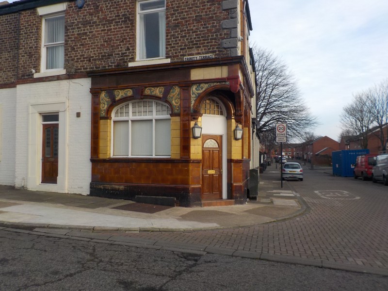
One of the many pubs (sadly closed) clad in glazed tiles – North Shields
Offshore construction shipyard, these are small offshore platforms – Wallsend
Looking across Segedunum at Wallsend

I follow a loop in the river loops and the centre of Newcastle comes into view. I catch sight of the very impressive Millenium footbridge spanning the Tyne in a double bow. From the bridge I look further west at the other road and rail bridges which have spanned the narrow Tyne over many years. With the wind at my back now I make good time, taking a circuitous route alongside the river and pass around industrial sites  wherever they occur. By midday the sun has begun to come out and excellent views back across the Tyne where I had previously walked a couple of hours ago. I decided on stopping at Hebburn for a couple of reasons, namely; I did not know how far I could get with the sunshine available, I wanted somewhere free to park and my next section which may be to Sunderland which is also on the Metro and  would make it easy to get back to my finishing point.

An enjoyable days walk, given the biting wind, but an area packed with history that would take me a too  long a time to stop, explore and describe.

The Millienium Bridge and other bridges in the centre of Newcastle
On the Millenium Bridge
Looking east down the Tyne near Hebburn
Looking across the Tyne near Hebburn. The small tower is the observation tower for the Roman fort at Segedunum

Distance today = 20 miles
Total distance = 3,393 miles


191. Newbiggin-by-the Sea to Whitley Bay

It had been a frustrating 4 weeks since I last did any coastal walking due to a host of circumstances namely; lack of 2 day weather windows (particularly in Scotland), a death in the family (my wife’s sisters husband), a poorly dog (now thankfully ok), football and a Christmas Fayre where myself and my wife had a craft stall, selling things we had made – Woodturning and crochet items. Unfortunately, Scotland was about to take the full force of Storm Caroline, So I opted for my back-up walking location – The North East coast.

My wake-up alarm did not go off as I had set the clock time out by 12 hours! So I set off in a bit of a mad rush to catch my planned transport links. Only one major diversion on the A38 – M1 which was something like 10 miles or so. I was very lucky with the next diversion as they were just pulling the cones in. I set off up the A19 which is dualled all the way to the Tyne Tunnel. I located a free car park in Whitley Bay and walked into the town centre to catch the #57 bus to Ashington, where I picked up the #X21 to Newbiggin. The combined fare was £8.30 which was rather expensive, but not too bad as the journeys took almost 2 hours. From the bus stop in Newbiggin,  I walked the short distance to the promenade.

The weather was a mixture of a stiff breeze with sunny spells amongst dull overcast grey skies. I followed the promenade out of Newbiggin getting a good view of “The Couple” statue sitting some 300m offshore on a metal frame. The statue by Sean Henry was erected in 2007 and was quite controversial at the time with the locals having mixed feelings about its siting. As I continued to walk south the sun made an appearance and it became difficult walking into a low strong sun. I reached a caravan site and headed inland slightly along the River Wansbeck. The path passed under the busy A189 and up to a weir with a footbridge on the top. There was a sign on a low locked gate which prohibited public access, I could see the sign lettering had been partly had been scrubbed out, also a number of footprints headed across the bridge and I decided to follow them. I headed back down the river and arrived back at the coast. I emerged on a minor road  which passed through the old mining community of Cambois.

Looking out towards The Couple at Newbiggin-by-the-Sea
Heading towards the weir and footbridge across the River Wansbeck

After 1.5 miles I headed inland again, this time to cross over the Sleekburn, then the A189. I briefly enter the outskirts of Bedlington, before emerging onto the A189 as I cross over the River Blyth. I descend onto a cycle track which followed the River Blyth into Blyth itself. Even though I had checked my route I encountered a couple of dead-ends which required me to retrace my steps. I met a chap out walking who was having his camper van worked on and needed to kill a few hours, he kept me company as we walked into Blyth. Blyth passed by in a bit of a blur as we were engaged in conversation. My new-found walking companion soon disappeared into a local cafe, while I continued  south.

Inland lighthouse in Blyth

As I left Blyth I joined a path that headed towards the dunes and continuesd onto Seaton Sluice. Further on I pass through the small village of Hartley. I continued along the cliff-top path as I pass St Marys Island with its lighthouse and buildings linked to the mainland by a tidal causeway. It is only 14:00 as I approach Whitley Bay but the sun had disappeared and it was getting quite dark already. However, I could still make out the brilliant white building of the Spanish City Dome. I headed for the car park to change and then onto my nearby B&B. I noticed I had passed out of Northumberland and into North Tyneside.

Heading south towards Seaton Sluice
Looking back at Blyth
The harbour at Seaton Sluice
St. Marys Island and lighthouse
Approaching Whitley Bay
The Spanish City Dome – Whitley Bay

Distance today = 18 miles
Total distance = 3,373 miles