45. Gurnards Head to Cape Cornwall

The last of my three day trip to North Cornwall. I have a small gap to complete, which although only 9 miles has quite an interesting section. I shall be walking through perhaps the best preserved area of Cornish tin mining surviving today.

I drive early to Cape Cornwall and park in the National Trust car park, like the other occasions I have used this car park there is no one there at the hut. There again being an NT Member I get free parking anyway. I walk into St Just and get the early morning bus bound for St. Ives. I get off at Treen, just by the Gurnards Head pub, where I finished yesterdays walk.

walk451
Looking towards Pendeen Lighthouse

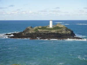
I walk through Treen again and follow the footpath directly towards Gurnards Head and the coast. The walking is very easy and I make excellent time. As I walk over Chypraze Cliff I am able to see Pendeen Lighthouse. As a lighthouse Pendeen is relatively new, being built in 1900, but becoming automated in 1995. I pass by the lighthouse and walk down a small lane.

walk452
Looking towards Botallack
walk453
Geevor Mine
walk454
Tin mine ruins
walk455
Tin Pools

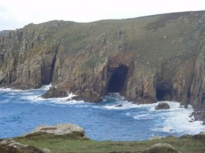
I can now see much evidence of mine workings, with numerous chimneys and building on the horizon. I am now entering the area containing the Geevor, Botallack and Levant mines. This whole area can be accessed by the SWCP and is a fantastic and interesting site. Although all closed down today, the Geevor mine operates as a tourist site offering mine tours and telling the story of the Cornish Tin Mining in the area. There are a number of information boards, scattered about. But you would probably need a guided tour to understand the whole process of tin mining and the functions of the many derelict buildings over the huge site. I espy the Crowns, a set of engine houses perched precariously on cliffs above the sea and probably the most photographed of all Cornish Tin Mines. I pass by the Levant Mine famous for its tunnels stretching out deep beneath the sea, where miners dug for copper and tin. This industrial area continues to Kenidjack Valley, where the path descends and follows a water course for a short distance before rising again out of the valley. Most the industrial buildings appear to be covered by vegetation, which hides many water stamps buildings to crush the ore mined nearby.

walk456
The Crowns

Although, I am now away from the main mine area, there are still numerous tin and copper mines close by. I descend to Cape Cornwall once thought to be the most southerly point of the UK, but that honour has since been passed to Lands End.


walk457
Cape Cornwall


Distance today = 9 miles
Total distance =   657 miles


44. Hayle to Gurnards Head

Quite a busy and complex day today, due to the timings of public transport. Although I have this section titled Hayle to Gurnards Head, my first section will be Carbis Bay to Hayle. I leave the hotel very  early and join the SWCP at the bottom of the garden from the hotel. I walk in the early morning light behind the large houses and cross the railway line via a footbridge onto the seaward side.

I enter a small dune system, Port Kidney Sands as the shoreline swings around and enters the Hayle estuary. I recross the railway line and walk alongside a golf course to a small church. I notice some new way signs that point to St. Michaels Way, a footpath that runs all the way to St. Michaels Mount on the south coast. The road rejoins the railway running alongside the estuary. I pass by the small railway halt of Lelant. I join the busy BB3301 all the way to Hayle. At the head of the Estuary I am walking along a well-trodden grass verge, where I pass a granite stone that tells me I am entering Hayle District. I stop close to the new Asda store in Hayle and get a bus back to Carbis Bay.

walk441
The Tate – St. Ives
walk442
Looking back at St. Ives
walk443
Zennor

At Carbis Bay, I walk into the centre of St. Ives with the intention of getting a bus out to Zennor. The bus is not going for a few hours so I opt to start walking to Zennor instead. The path is along low clifs and is fairly level with easy walking. I am soon at Zennor and the sun is very bright, amazing for late November! I walk into the village and find I have about one and a half hours to wait until the next bus back to St. Ives. So I opt to walk along the B3306 as far as Treen. At Treen is the Gurnards Head Pub, as I have made good time I decide to nip in for a pint. I order a pint of shandy which costs £3.62!!! I did not order a second. I drop down onto the SWCP and make my way back along the cost to Zennor, passing a few ruined engine Houses on the way.

I joined other walkers on the #14 bus back to St. Ives


walk444
Gurnards Head


Distance today = 14.5 miles
Total distance =   648 miles


43. Portreath to Hayle

Quite a short distance today, which was dictated by the difficulty of getting to Portreath from Hayle, where I had parked on a sunday morning. Because of engineering works, the train to Camborne was not running, instead a bus service was operating which I just managed to catch. I caught another bus down to Portreath, where I was the only passenger, well apart from the drivers son, who was accompanying his driver dad on this mornings run.

walk431
Portreath

I arrived in Porteath to a very chilly, but sunny and breezy day. I head across the car park and begin the climb up onto Western Hill and across to Carvannel Downs with its fine collection of Exmoor ponies. The walking is very easy and I make good time. I pass the Iron Age Cliff top castle of Crane castle, barely recognising any visible remains. The B3301 road now joins the path, running quite close. At Derrick Cove, I pass the nice viewing area built by the National Trust for people in wheelchairs. A lttle further on the road is now right alongside the path and offers a superb view down into Hells Mouth and spectacular views down to the beach. I see people enjoying an early morning cuppa at the famous cafe with the same name.

walk432
Spot the Seals
walk433
Godrevy Island with lighthouse

As I walk to Navax Point, I can see many Grey Seals far below me. I read on an info board that this is a popular breeding site and an area that the seals congregate in large numbers between October to April. At Godrevy Point I can now look out across to the small island of Godrevy with its lighthouse and further to my left, in the distance, the popular seaside town of St. Ives. The glorious beach of Gwithian stretches ahead of me for a few miles. I can see that it is very busy with surfers and dog walkers alike.

walk434
Gwithian sands

I cross over the Red River, so named after its appearance from the red iron oxide disacharged from the local tin miles. I am now walking in a straight line on the flat Gwithian Beach heading for a lifeguard hut two miles away which will be the place I leave the beach .

I walk through the numerous holiday homes at Hayle Towans and alongside the narrow River Hayle. There has been some quayside development of recent years, which has tidied this area up. I cross over the swing bridge and proceed into Hayle itself. It has been a short but very interesting walk

Distance today = 12 miles
Total distance =   633.5 miles


42. Porthcurno to Cape Cornwall

I parked at Cape Cornwall in the NT car park and walked the mile into St Just. I had to make use of two buses today to get me back to Porthcurno. The first was the West Penwith Community Bus which took me to Lands End. As the only passenger I had a nice chat with the driver on the short journey. My second bus was the stagecoach #1 bus which was heading back to Penzance via Porthcurno.

walk421
Day marks above Porthgwarra

It was quite a breezy and chilly start to the walk as I ascended out of the small valley up towards the Minack theatre. The theater was not open this morning and I was unable to catch a glimpse inside. The first settlement I come to is Portgwarra which sits in a small valley, there is a not a great deal there and I do not linger as the wind is very chilly. I ascend onto a fairly flat area. Although there are a few ups and downs, it is quite easy underfoot. I note two large day marks, which identify the position of the Runnel Stone, a scene of many wrecks.

walk422
Sea cliffs near Gribba Point

This whole part of the coast is famous for its blocky granite coastline with a number of impressive sea-cliffs and caves. In the far distance I can make out the buildings of Lands End. The drops and ascends a number of steep valleys, but I happy that I will soon pass around, what I would describe a milestone in the shape of Lands End.

walk423
Approaching Lands End

Although I had been a number of times to Cornwall, this would be my first visit to Lands End. But before I reach Lands End I pass a small farm/small holding with a small number of Vietnamese Pot-bellied pigs which I always find amusing. Land’s End does not offer a great deal, but I do get a good view out towards the Longships lighthouse and a photograph opportunity of perhaps one of the most photographed places in the UK, the finger-post pointing to John O’Groats.

walk424
Lands End
walk425
Sennen Cove

I quickly walk over to Sennen Cove and can now make out Cape Cornwall in the distance, it does not look that far away, but is still some 4 -5 miles. I descend the steep slopes into Sennen Cove, there are a few hardy souls out on the surf as I also drop onto the beach of Whitesands Bay. At this point a heavy rain shower arrives, which is with me all the way to Cape Cornwall. As I approach the Cape, Cornwall’s industrial heritage makes a re-appearance with a number of fenced-off mine shafts and the odd chimney. I complete the walk in a leisurely 3hrs and 50mins.


walk426
Cape Cornwall


Distance today = 11.5 miles
Total distance =   621.5 miles


41. Penzance to Porthcurno

I am away quite early from my B&B on the seafront in Penzance. Its a chilly sunny start, with rain showers forecast for the rest of the day. I make my way to the bus stop to catch the bus to Porthcurno. However, I can see no bus listed for this time. Grrr! I decide to carry on walking towards Porthcurno and get a bus back from there to Penzance. I don’t have any idea what time the buses go from there, so I decide to take a risk and see how it goes.

walk411
Looking across Newlyn harbour towards Penzance

The long walk along the promenade towards Newlyn is obstructed by a series of construction projects on the promenade itself. In no time I have entered Newlyn and walked around the harbour. I pass the large fish market and the impressive new harbour specifically built for the fishing fleet. I can see St Michaels Mount across the bay, soon I will turn south and lose sight of it. Not long after I get caught in a short sharp rain shower. I take shelter under a small tree which keeps me dry.

walk412
Mousehole

Just as approach Mousehole, I pass the memorial and site of the Penlee Lifeboat, which was tragically lost in 1981 while attempting to rescue crew from the coaster Union Star. I enter the charming and typical Cornish village of Mousehole with its tight and closely packed streets. I climb up a steep hill out of Mousehole. I pass the small hamlet of Lamorna and continue towards the oddly named Tater-du lighthouse. The cliffs are now composed of typical granite blocks.

walk413
Cobble beach at Paynters Cove
walk414
Penberth Cove

At Paynters Cove the path drops down to the cobble beach and I walk over the large cobbles for about 60 metres. There are a number of rusty wrecks and other debris from shipwrecks on the beach. I arrive at Penberth Cove, with its large 19th century capstan and fishing boats. The hamlet is often painted because of its unspoilt beauty. I round Cribba Head and walk above large granite cliffs down to Porthcurno. I see where the old cables from the late 19th century come ashore. I want to explore the area, however, just as I arrive in the car park so does a bus. The bus is going back to Penzance and I don’t know when the next will be. So I hop on and enjoy a lovely ride back to Penzance on the top deck. The walk has taken 4.25 hrs.

Distance today = 11.5 miles
Total distance =   610 miles


40. Porthleven to Penzance

walk401
Porthleven

I arrive in Penzance ahead of two walking days that will eventually take me around Lands End and onto the north coast of Cornwall. It is very windy, but sunny when I park up and wait for the bus to Portleven.

I know the first half of todays walk is going to be up and down, and so it was as I made my way out to Tregear Point. Here I pass a small monument with white cross to all those that have been lost at sea and the passing of the Gryll’s Act of 1808 which stated that any body washed up on the shore would be laid to rest in consecrated ground.

walk402
Mine workings at Trewavas Head

The path rises and falls all the way out to Trewavas Head, where I pass a number of old mine buildings and chimneys. All of the buildings are in a derelict state, apart from one, The Wheal Prosper mine, which has had work carried out on it by its owners, The National Trust.

walk403
Cudden Point
walk405
Beach walking near Perranuthnoe

As I descend towards Praa Sands I can clearly see my journey’s end across St Michaels Bay to Penzance. I can also see the headland heading out towards Lands End in the far distance. The walk along Praa sands is very easy-going, at Sydney Cove I climb back up to the path and continue on past Prussia Cove, named after a well-known smuggler. The path continues to rise and fall past Perranuthnoe all the to the village of Marazion. Here I follow the path down to the foreshore and walk a short section over large boulders.

walk404
St Michaels Mount

At Marazion, the easy walking begins, starting with a walk through the streets of the village and then onto a long, paved path sweeping around to Penzance in the distance. The causeway out to St Michaels Mount is visible, but having made the journey across to St Micahels Mount some 36 years ago I decide to continue onto Penzance and my B&B. The walk has taken some 5.25hrs.

Distance today = 14 miles
Total distance =   598.5 miles