72. Menai Bridge to Caernarfon

Really today was a planned very short amble of only 9 miles with my daughter Nicola. The walk was predominantly on tarmac and for most of the way accompanied by a road. I managed to find a handy little parking spot just by the entrance to the Menai Bridge.

Walk721
The beautiful Menai Bridge

The first part of the walk was through a wooded area behind the University playing fields. After about a mile we arrived at the newer Britannia Bridge. Slightly older than the original Menai Bridge, the Britannia Bridge was rebuilt in 1970 following a fire. The bridge carries the A5 to Holyhead on an upper tier and a rail track on a lower deck. The upper tier was a later addition and resulted in the 4 large stone Lions guarding both entrances to the bridge no longer being visible from the road.

Walk722
One of the ‘Lost’ Lions at the Pont Britannia

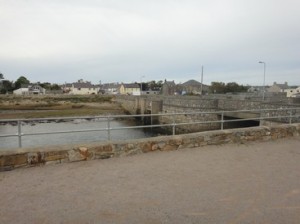
After passing through a small plantation, the path made an inland diversion due to the National Trust property of Vaynol Park. The path emerged on the main A487 road for a short section. At the roundabout the path follows the road through Y Felinheli. As we arrived in Y Felenheli, the heavens opened, so we took shelter in a covered bus stop until the shower passed.

Walk723
Looking east up the Menai Strait
Walk724
The main square in Caernarfon

After re-joining the A487, we walked along an adjacent cycle-way all the way into Caerfarfon. We walked around the Castle, which is wonderfully preserved and well worth a visit. We then sought out the Wetherspoon pub, The Tabarn an Porth, where we had sunday lunch and a pint of Doom Bar. We then caught the #5c bus back towards Bangor. However, the bus did not go near the Menai Bridge so we got off at the hospital and walked about a mile down the hill to the bridge. The Antelope pub sits just by the entrance to the bridge, so we popped in there also for a quick half.

We covered the 9 miles in 2.75.


Distance today = 9 miles
Total distance =   1083 miles

71. Newborough to Menai Bridge

This was to be my final leg on Anglesey and I was looking forward to an easy stroll in this late sunny autumn day.

Walk711
Stepping stones over the Afon Braint

I arrived early in Menai Bridge town to find the long-stay car park closed.  I tried another car park, this one is also closed also– it was full of fair ground equipment! Anyway, I find a quiet street and save myself £3. I catch the #42 bus and get dropped off right on the path at the roundabout at Pen Lon.

Walk712
I know the feeling!

Its quite a chilly start but I am soon warming up and heading towards the Menai Stait coastline. I am confronted by a set of huge stepping stones that enable the Afon Braint to be crossed. The sun begins to rise and it gets quite warm as  I walk along a small a tarmac road. I can make out the town of Caernarfon across the Menai Strait, knowing I should be there in two more trips..

Walk713
Nelson’s statue looking west along the Menai Strait
Walk714
The double-decker Pont Britannia bridge

Unfortunately, I am not on the coastline long before a big detour inland to avoid the NT property of Plas Newydd and another big property. Not much time spent on the coast in this section! I follow the main A4080 to the outskirts of Llanfair Pwllgwyngll where the path skirts down to the waters edge. I passed Nelsons monument on the tidal part of the strait and climbed up a small hill to a church which has a memorial to the people who died in the building both the old bridge and new Pont Britannia  bridge. The path passes under the Pont Britannia, which is very impressive when viewed from below. The path hugs the coast for a while before climbing back up onto the road, before skirting back down again to the coast as I entered Menai Bridge. Not a very satisfying walk with persistent diversions and detours. I covered the 14 miles in 4.5 hrs.

Distance today = 14 miles
Total distance =   1074 miles

70. Rhosneigr to Newborough

This section involved two walks, a long one and a short one, puncuated by a bus ride! I drove to and parked at the Llanddym Island parking spot in the Newborough Forest. I arrived at 8:30 but  no-one was at the toll booth to take the £4 parking charge. There were many other cars parked, mainly joggers and dog walkers. I asked a lady when I’d parked my car  and she said there was no machine, so at that time you did’nt pay. I did see  when I returned to the car park at about 16:00 a lady locking the toll booth up and leaving.

Walk701
Rhosneigr in the distance

To get to Rhosneigr I walked towards Newborough along the WCP, when I reached  the A4080, at the Pen Lon roundabout I caught the #42 bus to Aberffarw; where I changed buses and caught the #25 for a short hop to Rhosneigr.

When I arrived in Rhosneigr the first thing I could hear was the noise of engines from the Angelesy Racing circuit some 3 miles away!

Walk703
Barclodiad y Gawres tomb

The first couple of miles was easy beach and cliff-top walking before I came to my first port of call, the Barclodiad y Gawres, the largest Neolithic tomb in Wales. A metal gate blocks further investigation, but it is sometimes opended for guided tours.

Walk702
The church of St. Cwyfan on Cribinau
Walk704
Malltreath

The noise from the motor racing circuit increases as I get closer and the path makes an inland detour to get around the circuit. I see many marshalls, but cannot see any of the action until I emerge at a small bay called Porth China. I can see that motor bikes are being raced, as part of the circuit is now visible. I also noticed the small tidal island of Cribinau, with the 13th century church of St. Cwfan. As the tide was out, I visited the small church. Apparently, the church was once connected to the mainland, but erosion of the boulder clay made it an island. The remaining portion of the island and graves has been protected from further erosion by a stone wall around its perimeter. Unfortunately, the church was locked when I visited. It was kind of strange having motor racing a few hundred meters away, while I was sitting on this lovely tranquil island.

Walk705
Snowdonia and the Lleyn from Ro Bach beach

I round a small headland and followed the Afon Ffraw into  Aberffraw, the ancient capital of the Kingdom of Gwynedd. The Afon Ffraw was tidal, but today I could have simply taken my boots off and walked the 6 steps across. I opted to stay until the bridge and walk back alongside the opposite bank.

After the small beach of Aberffraw Sands the WCP sweeps inland for a large detour around the Bodorgan Estate, which is notable for having very few public footpaths on its Estate. The large detour takes the path directly into another small village, Malltraeth. It was here that attempts were made in the 19th century to reclaim land lost to the sea by building a large wall, The Cob, along which I walked. My next section was Newborough Forest, which is huge , although Forest tracks hold no great appeal to me. After 3 miles of forest walking I emerge onto the beach at Ro Bach. I could walk out to the attractive island of Llanddwyn, but it has been a long day and I am tired. The beach is very busy and crowds are enjoying the late autumn sunshine.

Distance today = 20 miles
Total distance =   1060 miles

69. Trearddur Bay to Rhosneigr

I parked at the free car park at the library in Rhosneigr. I caught the early #25 bus to Caergeiliog. After getting off the bus I had all of 30 seconds before the #4 to Trearddur Bay arrived. It’s not that this is a really frequent service, I was just lucky because my first bus was late.

Walk691
Looking towards Anglesey Airport at Traeth Llydan

The weather had begun to clear from raining most of the night, to blue clear skies by midday. The walking was very easy along the coast, which was quite flat. I passed close to Rhoscolyn keeping half an eye open for the third of Anthony Garrartt outdoor paintings.

Walk692
Four Mile Bridge

I arrived at Traeth Llydan and could easily see Anglesey Airport across a tiny water course. However, I was still on Holy Island  and I now had to make a large detour north towards Four Mile Bridge. The route was predominantly on roads and had little of interest to offer. Four Mile Bridge is the name of the village that sits alongside a bridge that connects Holy Island with Anglesey.

Walk693
Exposed breached old causeway

I cross the bridge and pass a couple of farms. My luck is in at Penrhyn-hwlad where a low tide has exposed an old breached causeway. The causeway was easy to negotiate and saved me about a kilometre of walking around the inlet. I pass under and around the landing beacons and lights and finally around the airfield perimter before walking last couple of miles along beach. Took 4.75hrs to cover the 16 miles.

Walk694
Looking ahead to Rhosneigr


Distance today = 16 miles
Total distance =   1040 miles