98. Cardiff – East to Whitson

Today was going to be my penultimate section of the WCP. It had taken abit of planning to get the mileages right, so my final day would not be a “gut-buster” . I opted for a place near Whitson, called Seawall. I managed to find a free parking space and walked the half- a mile back up the road to Whitson and the bus stop. This area of Newport is served by what is known as Demand Responsive Transport. What this means is you call them up and agree a time and pick-up spot and they send a car. You have to give them your name and address, so I’m not too sure how that works with tourists etc… Anyway they have retained two scheduled buses a day, so I caught the #63 at 8:00 to Newport, it was then a case of getting the Cardiff train, then catching another bus , the #11 out to Pengam Green. After all this kerfuffle, i did not start walking until 10:00. The weather was beutiful and sunny and with reasonably good visibility. I soon got the heavy traffic and industrial areas behind me and proceeded along the large straight dyke or seawall.

Walk98a1
Tawney Owl

A few miles along the seawall, I noticed an owl perched on a fence post, about 20 meters away. It was being pestered by a single crow, but held its ground. I had never so close to an owl in the wild before. It did the ‘swivel-neck’ on me to check who I was. (Checking my RSPB guidebook the owl looks to be a Tawney owl, as opposed to a Short-eared Owl).

I pushed on towards Newport. I notice how the far shoreline across the Bristol Channel of Somerset and Bristol/Avon is getting closer now. I can pick out individual houses and occasionally I get a sunlight reflection from a car mirror on the far bank. I press on and pass West Usk Lighthouse, now a B&B. I notice a Rolls Royce parked in the drive. Hmmm….

Walk981
New WCP footpath bridge over railway

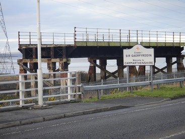
As the path moves inland, I see that the road as been diverted because a bridge that previously went over the railway has been demolished. The WCP footpath, however, has its very own footbridge over the railway now.

The WCP signage around this area gets a little crazy, some stupid pointers. I pass some retail shops and pop into Lidl for a couple of bakery items. I am looking forward to going over the Transporter.

Walk983
The Newport Transporter Bridge

The bridge is open from 10 – 16:00 and is the main reason I decided to walk in this direction. The bridge is one of only 3 in this country and I think together with Middlesborough is the only other working bridge in the UK. I opt to walk over the top and get charged £3 – a bit steep if you consider that to ride in the gondola would have only cost £1. I get a brief safety talk and am then allowed to climb to the top and walk across. Even though there was little wind, I felt a very slight swaying in the structure. The views were well worth it. I descend and then continue walking through the industrial suburbs. I walk around the Wetlands and continue past the “stumpy” little sister lighthouse of East Usk (which is still operational).

Walk982
Up top on the Transporter Bridge

By now my feet are quite sore and painful. I wish I had brought a change of foot ware, as I had reverted back to boots for this section. I passed through Goldcliffe after which the path headed back to the coast at Seawall ( close to Whitson). The walking had been tough, due to sore feet , but memorable because of the owl and the transporter bridge.

Distance today = 20 miles
Total distance =   1527 miles

97. Barry to Cardiff – East

With 58 miles to go to the end of the WCP, I looked at the logistics of getting this done with three more trips. I therefore decided to do a fairly short day of 16 miles, which would take me to the east of Cardiff. My daughter Nicola accompanied me on this walk, although I failed to mention to her that it was 16 miles!

Walk971
The walk alongside Cardiff Bay

The sun was well and truly up as we parked near to the Tesco store in Pengam Moors. A #11 bus, which would take us into city centre, arrived within 30 seconds of us standing at the bus stop. We alighted from the bus slightly early to have a quick look at the Castle and the Millenium Stadium. The Millenium (or Principality as it now) is an amazing building, crammed tight into a space right in the city centre. We caught one of the frequent trains to Barry, where we started walking 25 minutes after starting out. The first 3 miles or so where alongside a road and through mainly industrial parts of Barry.

Walk972
The Norwegian Church

We eventually emerged on the coastal path as we passed through Sully. The path was straight, flat and dry. Good views were had across the Bristol Channel towards Weston-Super Mare. After rounding Lavernock Point we encountered increasing numbers of walkers who were coming from the direction of Penarth. As we entered Penarth, the crowds were out in force on this glorious Easter Bank Holiday. As we climbed through the town, we were rewarded with a great view across the Bristol Channel and back down to Penarth.

Walk973
War memorial statue – beautiful!!

We descended over the hill down towards  Cardiff, where we had great views down to Cardiff. The Cardiff Bay barrage was an amazing piece of engineering. It was an incredible sight seeing the height of Cardiff Bay some 7m or 8m higher than the receded tide mud flats of the Bristol Channel. The whole area was alive and busy with people. We passed the Dr Who exhibition, the Norwegian Church and  some incredible statues. I particularly liked the War Memorial statue of a face carved into the bow of a ship – simply amazing. I also thought the Welsh assembly building and Wales Millenium Centre was brilliant with its purple and green slate brickwork and the champagne-coloured stainless steel cladding was very striking. I must look up the meaning of the words “In these stones horizons sing”, which was emblazoned across the building.

Walk974
Wales Millenium Centre

The walk out of Cardiff was tedious and we both started to flag abit. we agreed that a cup of coffee would be nice, but could see nothing in sight, then not more 30 metres away Nic spotted a Greggs!! Result. A cup of Coffeee and pastry slice for £2 was fantastic value. We sat in a nearby bus shelter and ate our lunch. We were joined by a gentleman, who was also walking the WCP and we talked for a while about the Path.

Walk975
Dockside crane at Atlantic Wharf – relic of years gone by

The last mile or so close to the Tesco store is best forgotten. As we passed close to a permanent Travellers site, the rubbish and fly-tipping was probably the worst I have ever seen. I have seen cleaner cleaner council tips!! The rubbish and filth was not restricted to outside of the site, but inside the site rubbish, refuse and scrap was piled sky high. I have walked past other Traveller sites and most are clean and well kept. This site however, was truly appalling – disgusting even!

Walk976
Colourful roundabout

Despite the end of our walk, I really enjoyed walking through Cardiff. The Bay area was a delight and a place where I would like to go back to.

We managed 5.5 hrs for the 16 miles.

note: because of the wonderful things to see I found it very difficult to limit myself to showing only 4 photos, so I have done 6 instead!!


Distance today = 16 miles
Total distance =   1507 miles


96. Barry to Dunraven Bay

Today was going to be a very early start, as the bus times meant a late start; I therefore decided to drive to Barry rail station where I parked and begin walking straight away. Withe the sun now rising at just after 6 in the morning, I started walking at 5:55!! I like walking  very early in the morning because its generally cool and quiet. It was quite light at this time, but a bit nippy.

Walk961
Sunrise over the Bristol Channel from Barry Island

The rather tedious task of walking around Barry Island was my first objective. I managed to capture a photo of the sun rising over the Bristol Channel, it looked really beautiful. Not so Barry Island though, as within 30 minutes I had stepped in dog crap twice! Barry Island is certainly an oddity,  a nice residential area but the theme park stuff with rides etc, do look out of  place. As I crossed back over the harbour road I could see my next objective Cold Knap Point. The suburbs of Barry eventually disappeared as Rhoose Point (southermost point of mainland Wales) came very quickly. Here you could see at close hand, from the previous extensive quarrying, the beautifully bedded limestone strata that would be pervasive for the rest of the walk.

Walk962
Alternative fuel source at Aberthaw coal Power Station

After passing through a poorly signed holiday park, I eventually picked up the path again which soon dropped down to the West House Beach. I then followed a sea wall which shepherded me around the periphery of the Aberthaw Power Station. After the power station I noted the WCP went inland on a bit of a detour – I opted to walk across the beach and pick the path back up after 2km – unsure why this detour is there?

I had good views to the north where Llanwit Major could be seen, about a kilometer away. After dropping down to Cwm Col-huw I decided to walk along the beach as far as St. Donats.

Walk963
This Limestone Pavement was like a billiard table

The walking was easy on the Limestone “Pavement” with it’s classically weathered surface of “Clints” & “Grikes”. I had a brief look into the Boarding school at St. Donats and then climbed up through a wooded area to be greeted with the Nash Lighthouse and cottages. Walking along the cliff top was a delight, not only because the terrain was level, but it was also dry with the lack of rain over the previous 2 weeks. At Cwm Nash I decided to walk along the beach again all the way to Dunraven Park.

Walk964
Looking down on Dunraven Bay

I had a slightly steep climb up and down into Dunraven Bay, which had a few people taking the mid-day sun. My walk concluded at Dunraven Bay, but I needed to continue up the road into Southerndown, where I caught the #303 bus back to Barry at a cost of £4.80. My previous concerns about the reliability of this service were ill-founded as the bus appeared bang on time, but not before I was able to down a quick pint of Doom Bar in the 3 Golden Cups. A lovely day of walking with limited hazy views but a number of interesting things along the way. My time of 6.75hrs for the 23 miles was probably down to the beach walking and the level terrain.


Distance today = 23 miles
Total distance =   1491 miles


95. Dunraven Bay to Margam

With the high pressure still clinging to the UK, I thought I would take advantage for another quick stint on the WCP. The forecast had been for overcast and cloudy skies for the majority of the UK, but for the west sunshine was forecast – and they were right albeit a bit hazy. This section required that I get two buses, I decided to reverse my route due to bus timetables. So I parked at Margam again and caught the 6:42 #X1 to Bridgend at a cost of £5. I then then had a bit of  a scare with the #303 (cost £2.45) being 25 mins late, apparently it happens a few times, which is a bit worrying as I will need to use this service again. I got off at Southerndown and walked down the beach road to Dunraven Bay.

Walk951
Looking towards Ogmore-on-Sea on a glorious morning

The walk back past Ogmore-on-Sea was a delight with the crisp morning air from the overnight frost, the soft short grass underfoot and the warm hazy sun. I had a quick look at the beach outflow of the Ogmore River and decided I could probably wade that, if I did not mind getting my boots wet. As I wasn’t wearing boots I opted for the drier option and proceeded on the inland diversion.

Walk952
Stepping stones at Ogmore Castle

I did manage to get across the stepping stones at Ogmore castle. A few of the stones were slightly below the water and a couple had green (slippery) algae clinging to them. Using my walking stick as a support I managed to get across without my pride damaged. Actually, the stepping stones offer virtually no advantage from the official path a few yards up the road. As I left the village of Merthy Mawr I heard a couple of woodpeckers and and finally managed to catch sight of the pair, they appeared to be Greater Spotted Woodpeckers, but I am no expert.

Walk953
Steelworks rising above the dunes

I passed through Merthy Mawr warren and onto the beach, which followed around to Porthcawl. The sea front of Porthcawl was quite busy with strollers, walkers, joggers and just people enjoying the early morning sun outside of cafes and tea rooms. The path continued out of town towards the Royal Porthcawl Golf Club, where many golfers were out on the Links trying to improve their handicap. But the most popular activity seemed to be surfing, with literally hundreds of surfers all along the beach for more than a mile. However, the sea and waves were quite benign with only smallish waves. The walk through Kenfig Burrows was quite impressive, particularly with the size of the Nature Reserve, it was massive and somewhat disorientating if you lost your bearings. I had no problem with any floods and could easily circumvent any of the minor pools. Unfortunately, I had little in the way of views due to the hazy conditions, but with Tata Steel works getting closer I knew I was back to the outskirts of Margam.

Walk954
Derelict marshaling yard at Margam Moors

I passed an overgrown and derelict marshalling yard for the steel works, before I re-joined the main road leading into Margam. I managed the walk in 5.25hrs for the 19 miles.


Distance today = 19 miles
Total distance =   1468 miles


94. Oystermouth to Margam

High pressure over the UK for most of the week meant it would have been remiss not to take advantage. So it was an early start from Shropshire to drive to Margam, just outside Port Talbot, and catch the 7:15 #X1 to Swansea. I gulped at the £5 charge, but upon examining my ticket I could see that the ticket was a Swansea Bay Adult Day Traveller, which meant that the onward bus to Oystermouth was covered by the ticket. Perhaps that were I went wrong last week when I complained about the high prices – I should have bought a day traveller ticket type.

Walk941
The type of terrain for most of the walk

I got off at Oystermouth and literally launched into my walk. This was to be a trainer day, with a light rucksack as well. If I needed additional water then I would simply buy. The path followed the road and shoreline right around in a big sweep towards Swansea. The day was a beautiful sunny day with a nice sharp, but gentle breeze. I was joined by a multitude of people jogging, cycling, walking – mainly doggies and people going to work. I was making excellent time (finished in 5.25hrs)  and loafing around is something I rarely do, so I do miss some things sometimes.

Walk942
Used gym equipment exhibited as beach sculpture

But I did notice some interesting use made of old gym equipment being used for beach sculpture. The path passed through part of the University buildings and attractive beachfront apartments. In no time I was crossing a footbridge over part of the harbour. I skirted around the Prince of Wales Dock, after which the path followed a straight, overgrown and quite boring canal path called the Tennant path – not my cup of tea.

Walk943
Beached whale at Aberavon

The path emerged on a road which led to the A48 and joined the M4 in a twisting spire of slip roads which were well above the path. The path now on the A48 crossed over the River Neath and afforded excellent views not only across to the M4 bridge but also  back up towards the Vale of Neath. The WCP then dropped down towards the old docks – but with little remaining – apart from the Brunel Tower. Before long it was back to the coast and a spot of beach walking which continued for several miles.

Walk944
Dominating the skyline – The Port Talbot steelworks

The beachfront at Aberavon is in a state of flux with new developments ongoing. The path then moved through a much rougher area, with litter and rubbish in abundance. The path then followed new roads linked several roundabouts opposite the Port Talbot steelworks. The last 2 miles was spent walking at the back of the houses that fronted onto the A48 amongst litter, rubbish and dog muck!


Distance today = 20 miles
Total distance =   1449 miles

93. Rhossili to Oystermouth

What a difference a day makes! When I alighted from the #118 bus I was treated to a very different Gower, with almost cloudless skies, a tranquil sea and views stretching across the Bristol Channel to Devon and Somerset. With a slight breeze to take the chill off the air I walked out to the coastguard lookout station 0verlooking the Worms Head. No chance of getting out to Worms Head for some hours as the tide was well in.

Walk931
Looking out towards Worms Head

The next 7.5hrs was beautiful, walking mainly on springy and with few descents I was treated to stunning scenery which you normally associate with limestone country. There were a number of small valleys that I had to pass over which were probably the result of collapsed sea caves.

Walk932
High Tor

At Port Eynon I was able to walk across the beach before re-joining the path again at Horton. My least favourite part of the walk was upon rounding Oxwich Point, the mile or so walking through Oxwich Wood were the path persistently went up and down steeply. I was pleased to see that Celandine had come into flower – always a sign that spring is around the corner.

Walk934
Looking back to Oxwich Bay from Three Cliffs Bay

At Oxwich Bay the tide was well out and I was able to make a B-line for Pennard Burrows. On High Tor and the other smaller tors there were a number of climbers trying out their skills.

Walk933
Looking towards The Mumbles

After passing through Southgate I was never far away from other walkers, particularly after Caswell Bay where the path became a tarmac route all the way to the Mumbles. I had decided initially to terminate the walk at the Mumbles, but I knew there was only one bus that went from there. I decided therefore to continue another mile on towards Oystermouth, where there more bus routes and would make it easier to resume my next section. The legs did not appreciate this though, as the 25 miles were taking their toll. I finished 8hrs after starting out from Rhossili. Perhaps one of the best walks along the Wales Coast Path.

Distance today = 25 miles
Total distance =   1429 miles

92. Rhossili to Gowerton

My attention next turned to tackling the Gower. I decided I would make a 2-dayer out of it, using Swansea as my base. I knew the weather would be not so good for the first day and my fears were soon realised as I drove down over the Brecon Beacons in a snowstorm!


Burry Holms
Burry Holms

My first section was to be Rhossili to Gowerton, to do this section meant catching two buses. I parked in Swansea close to the hotel I was staying at and caught the 07:50 #118 to Rhossili at a cost of £4.80. When I alighted at Rhossili it was like stepping into a hurricane, although the horizontal rain was not too bad, the wind of 40 – 50mph was directly at me full-on. I had this for the majority of the day, especially when the path veered to a northerly direction. The first couple of hours was tough, particularly as I battled the winds along Rhossili beach to Burry Holms.  I was forced to look down at the ground as the sand was whipped up and blasted at me.


Whiteford Burrows
Whiteford Burrows

I had a brief respite as I turned east, but then had the onslaught again all the way out along Whiteford sands.

I encountered a couple of problems with the path around Cwm Ivy, the first was the collapse of part of the sea-wall.


Drifting sand at Berges Island

This was easily circumvented by clambering down to the right of my photo and picking my way over the wall debris. However, further up I was stymied by the stepping stones across one of the small channels, which were not visible. I could have easily vaulted the channel with the aid of my walking stick, but I had not brought it with me this time. So I then followed the high tide route.

Collapsed Sea wall at Cwm Ivy

Cheriton, Llanrhidian and Crofty came as the path eventually led onto a small flood-risk  and high tide prone road. The road was quite welcome by this time as the state of the fields, particularly with livestock in them, made the going really tough.

I was able to enjoy fine views across the Llanrhidian Marsh and Loughor Esatuary towards Burry Port and Llanelli. This section had a great amount of tarmac, which I did not mind so much. I made good time and progress after Pen y Clawdd and soon arrived at Gowerton to link up with my previous section.

I then had to catch the second bus of the day back to Swansea. I was lucky and only had to wait 15mins for the #116 at a cost of £3.80. I was surprised at the cost of bus journeys (even short ones) around Swansea and Carmarthen. I suspect they do not attract the subsidies that services in Mid and North Wales enjoy. The walk had taken 7.5 hours for the 21 miles.

Distance today = 21 miles
Total distance =   1404 miles

91. Gowerton to Burry Port

I originally intended to walk from Burry Port out onto the Gower, but the lack of any bus transport on a sunday to the Gower meant a re-think. However, I did see that there is a regular train service between Burry Port to Gowerton, I would do a shorter walk of 12 miles today. As usual it was a very early start for the drive down to South Wales. I noticed as I drove through the Brecon Beacons that the snow was down at quite low levels, but it would not be troubling me today.

Walk911
The ruins of Loughor Castle

I parked at Gowerton railway station and was away by 7:00 walking to pick the WCP up about a mile down the road. The light was good, although it was very cold on my hands…..mitts on. I made my along quiet roads and paths before I came to the Loughor Bridge which  unsurprisingly spans the River Loughor and marks the municipal boundaries of Carmarthenshire and Swansea. Closeby the bridge, on a small hillock, is Loughor Castle, a Norman castle that has been in ruins for centuries.

Walk912
Part of the original Brunel Viaduct at Loughor

As I approached Llanelli I picked up what is the Millenium Coastal Path, which runs for 13 miles from Llanelli to Pembrey park and more or less follows the WCP. The path this morning was very busy with walkers, dog walkers, joggers and  cyclists all getting a lungful of fresh air. The path west from Llanelli is wide and  of good quality and seems to be marked at various locations with a silver needle piece of sculpture.

Walk913
Millenium Coastal Path sculpture

I passed a set of Rugby posts which appeared not to be part of a rugby pitch and with metal cuts of two rugby players. The goal posts apparently stood at Stradley Park, which was a  famous rugby venue some years back. I’m not a rugby fan, so it was all news to me.

As I approached Burry Port I was confronted with a number of  plaques all  claiming that Amelia Earhart landed here or stepped ashore here in 1928 after completing a trans-Atlantic flight. On this ocassion, Earhart was merely a passenger, but four years later in 1932 she was to become the first woman to fly non-stop  across the Atlantic.

Walk914
Stradley Park goalposts, with cut-outs

I arrived in Burry Port and made my way to the rail station and catch the 10:33 train back to Gowerton. I must admit I was not particularly enthused by this walk, I think it reminded me a bit to much of the Costa


del Rhyl. Managed to do the 12 miles in 3hrs 15mins. Next up will be a 2 day trip to the Gower.


Distance today = 12 miles
Total distance =   1383 miles