Well I certainly have not forgotten about this, but the fact that I still have circa 14 – 16 more days of walking before I finish my walk, so I did not want to go “gung-ho” at this late stage…just yet.
But I have good news. Besides having sufficient pieces of wood to start and finsih this process, an unexpected source of new wood arrived a few weeks back. One of my friends Dave Hutton, who lives about a quarter of a mile away was having two large trees removed. Dave, kindly offered me one of the trees, a large Black Pine. Black Pine or Corsican/Austrian pine is an imported tree popular with the Victorians who planted it in an ornamental capacity in their large grounds. Although, now used in commercial tree plantations, the Black Pine is subject to a disease known as Red Band needle blight. As this tree and another sat next to a busy road, Dave called in professional tree -fellers.
The diameter of the trunk at it’s base was almost two feet and meant that to get the full benefit of the wood the sections needed to be 24″. The resulting “logs” weighed something like 100 150kg, impossible handle. So I asked that the sections be cut in half down the middle and through the pith, something I would have had to do when I got the wood home anyway. I was thus able to load the sections into my car with the help of Dave. It took most of the day transporting the wood to my home .
I surveyed these huge pieces of wood and decided that the bowls would be too heavy and that Platters ( a sort of large flat dish) would be better. However, the diameter of the pieces would range from 14″ through to 20″, which my wood turning lathe could cope with by turning “off the bed”. The next issue would be safety. My lathe, although variable speed, has a minimum speed limit of circa 550rpm, far to fast to turn these large pieces. So I found a company that offer conversions to give better control of lathe speeds. So I packed my dismantled headstock off to Preston for its conversion. Where it remains as I write.
In preparation for the turning I needed to cut the huge pieces in slabs of wood 4″ thick and has perfectly round as possible. This preparation is critical as any weight imbalance would be magnified the larger the diameter. Its a bit like balancing the wheels of your car, only with the wood the imbalance would be far more violent and could shake lathe or worst cause the piece to become detached – having a 25kg piece of wet wood flying through the air at you is no laughing matter! So as you can see from the photos below I am preparing and accumulating what look like a set Cheese Round or Truckle. I’ll continue to prepare the wood until my headstock conversion is ready to collect from Preston.
The Black Pine pieces
Preparing the wood into slabs, lots of chainsawing
A 4″ thick slab of woodMarking out the size of the platter, this one will be 19″ diameterMaking the wood nice and flat. This Stanley Bailey No. 6 jointing plane was built in 1899. Its one of my prized possessions. I restored it and will continue to use what it was intended for and as tribute to all those who used it before me.The finished round or truckle. I wrapped it in cling film to try and stop the wood drying out too quickly before I begin turning it.
After yesterdays unintended extended walk, I decided I would have a much shorter day. I managed to escape from Pontins at the ungodly hour of 06:00, handing my chalet key to the guy on the gate. I had decided to reverse my direction of walk today because of the bus timings, which meant an earlier start. It also meant I could park up at Rye railway station again to get the bus to Fairlight, a small village close to Hastings Country Park.
I caught the #101 bus service from Rye getting off close to Fairlight and walking the short distance down to Hastings Country Park. Even at this time of the morning the car park was full of cars and camper vans. The weather looked a bit more settled with no showers forecast, just a grey overcast sky.
The topography around Fairlight would be a dramatic change from my previous flat sea-wall walks, as the much higher ground of the Weald anticline exposes a collection of sandstones, siltstones and mudstones, resulting in high unstable cliffs. One of the good things about reversing the direction of walk today was the fact that I would be starting on the high ground and walking to the lower.
I made my way downhill and onto the residential streets of Fairlight Cove and up onto Fairlight Hill. Close to the top I met an elderly gentleman who was training his Spaniel on game retrieval, we chatted awhile and he related a number of stories on attempts to reduce the continual erosion of the Fairlight cliffs. By the time I came to Cliff End I could look down on the Sea wall that ran along Pett Level. I descended down into the village of Cliff End and found the start of the Military Canal which I had previously come across on my walk through Hythe. I transferred onto the sea wall headed across Winchelsea Beach.
Early morning at Hastings Country Park looking across Rye Bay to Dungeness
The cliff-top road at Fairlight Cove
Looking down on the Pett Level and Winchelsea Beach from above Cliff End
The path continued onto and through the Rye Harbour Nature Reserve. Most the reserve was composed of shingle and was quite similar to that on Dungeness. The area was quite desolate apart from a building that came into view. This was the lifeboat house of the Mary Stanford. In November 1928 during a great storm, a distress call was received from the Alice of Riga steamship. The lifeboat crew of the Mary Stanford responded and launched into heavy seas. This lifeboat had no engine and was powered by oarsmen. Just after the lifeboat was launched a message was related that crew of the Alice of Riga had already been rescued and the lifeboat could stand down. Unfortunately, because of the poor weather conditions the flares could not be seen by the crew and sometime later the lifeboat capsized with all 17 crew members perishing.
I soon emerged at the mouth of the River Rother where it entered the sea at Rye Bay, the river had been ‘channelised’ back in the 1930’s. Here I met many other walkers who had parked at the large nature reserve car park at Rye Harbour. I passed by the impressive and newly built Rye Harbour Discovery Centre, closed today for staff training. The road into Rye itself had a good footpath and passed by a number of industrial works. As I entered Rye I crossed over bridge’s spanning the small Rivers Tillingham and Brede, before arriving back at Rye Railway station.
The start/end of the Military Canal
Looking back at Cliff End from the sea wall
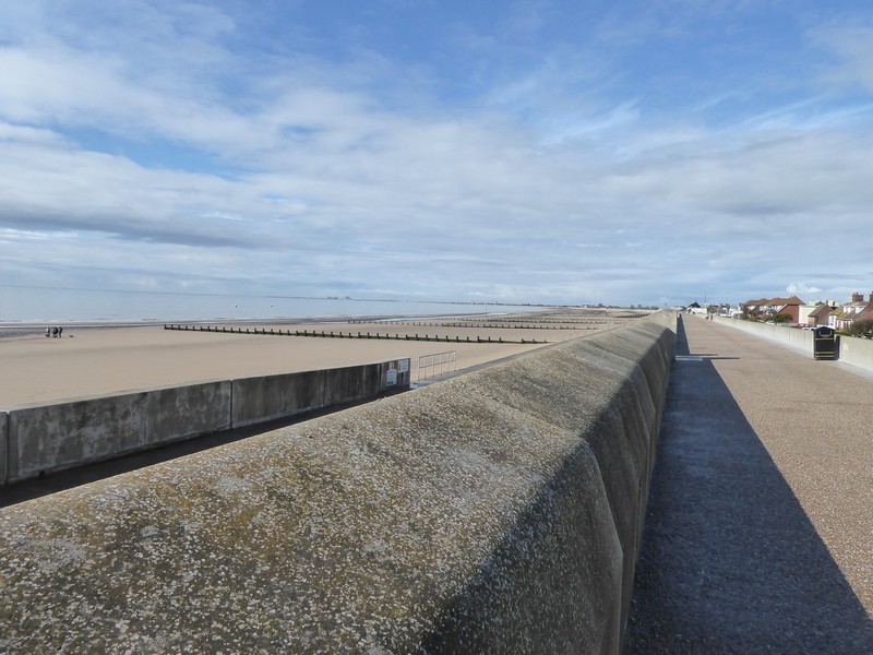
Heading along the sea wall at Winchelsea Beach
I passed this little bird who was very vocal, possibly a female Wheatear
The Lifeboat House of the Mary Standford
The mouth of the River Rother
The newly built Rye Harbour Discovery Centre
Locks on the Royal Military Canal at Rye
The River Brede at Rye
Distance today = 11 miles
Total distance = 6,406 miles
Well it’s been quite awhile since I last updated my blog, October 2020 in fact! I have been busy though, with a range of gardening and DIY projects all completed through our recent lockdown. I have managed a few local walks over the Winter, but nothing too strenuous, thus my apprehension about starting my coastal walk up again.
My plan was continue where I left off in Dymchurch in Kent and continue walking westwards over two days. To break me gently back into the routine, I had planned a couple of easy days with an overnight stay, well that was the plan!
I made a very early start from Shropshire to avoid the morning traffic on the M25. I parked up in Rye railway station car park, at £2.90 a day , it was a reasonable charge compared to other council run car parks. I then had to get to the start of my walk at Dymchurch. The Traveline website gave me a route which involved three changes of buses, but curiously all with the same bus service number – 102. Only as I was about to alight at Lydd, did I find out that the same bus ran the whole way to Dymchurch – it turned out to be an expensive fare for me! At Dymchurch after getting off the bus I walked the short distance to the sea wall along a path I had trodden some 7 months ago.
The weather was cloudy with the odd shower around. I could still just about make out the French coastline and the whole coastline back towards Folkestone. I passed by two Martello Towers as I left Dymchurch behind me. My view southwards along the coast was drawn to the large square buildings of Dungeness Power station in the far distance. I continued along the sea wall past the small villages of St Marys and Littlestone-on-Sea. As I entered Greatstone-on-Sea not only did the sea wall end, but the first of many frequent showers hit me. I soon transferred down onto the wide open beach where the compacted sand made for easy and rapid walking.
Heading south from Dymchurch along the sea wall
A Martello Tower with canon on top
Looking NE towards Hythe and Folkestone
I transferred back onto the Dungeness access road just before the Pilot pub, one of two pubs on the weird and wonderful headland that is Dungeness. I was now heading towards the newer of the two lighthouse, although this was in fact the sixth lighthouse to be built on the shifting shingle. A collection of small cabins, shacks and cottages soon appeared, each with a different appearance and were scattered over the landscape which is also home to a collection of flora and fauna unique to this part of the UK. All of this though was overshadowed by the twin power stations of Dungeness A and B. While Dungeness A ceased generating back in the ’80s, B has a new 10 year licence to begin generating again this year after a string of earlier safety concerns.
On the beach near Greatstone-one-Sea with an heavy shower approaching
The Pilot Pub on Dungeness
This is a Beach Tanning Copper which were used for dyeing and preserving fishing nets and clothes from the ravages of the sea
This is Prospect Cottage, the home of the late film director Derek Jarman
Huts selling freshly caught fish
The new lighthouse
The old lighthouse
Dungeness A and B Nuclear Power Station
Heading westwards along the shingle
I was now heading westwards past the Power Station towards the MOD Lydd Firing Range. The rat-a-tat of heavy machine gun fire and red flying flags confirmed my worst suspicions – the range was closed to walkers! I had checked the firing times for the range on the gov.uk website and could see the only firing was the day AFTER my walk. As I write this the website still says no firing on the 19th May. I walked to the control tower spoke to someone to query why the website was saying one thing. A chap said he would pass my complaint onto the office…. yea … yea. I had intended to walk along the coast towards Jurys Gap, but this now meant an additional 2 miles inland detour via Lydd. I followed the firing range boundary perimeter into and out of Lydd.
The control tower at the edge of the Lydd Firing Range
Heading towards Lydd along the firing range perimeter
The reason for my detour, the Army with machine guns mounted on Land Rovers
The road from Lydd out to Jury’s Gap also followed the Lydd Firing range, fortunately there was a good footpath set back from the road. Soon after leaving Lydd I heard my first Cuckoo of the year and spotted the little fella on a branch about 50 metres away. With the sea wall now in sight I passed from Kent into East Sussex. I had been walking in Kent since February last year, so it was good to see some progress. I eventually arrived at Jury’s Gap and climbed up onto the sea wall. The rain showers had begun to get increasingly more intense and as I walked through Camber I got a severe drenching. I headed along a footpath heading towards Rye, which ran alongside the golf course. I soon heard the unmistakable sound of thunder coming from a particularly dark patch of sky about a mile away. As I passed the club house I heard a siren go off which I presumed was a warning to the golfers out on the course. There was no shelter nearby so I waited a short while close to some shrubs. I caught sight of some lightening strikes about an half mile away. As I waited I was relieved to see that the thunderstorm was heading away from me and out to sea. I could still hear rumblings from other dark clouds some distance away. As I crossed over the River Rother into the ancient Cinque port of Rye the sun was well out and it became very warm. I climbed up into the town and through the old Landgate and down to the railway station.
It had been a tough days walk and much longer than I had originally intended. All that remained for me to do now was to drive down the road to Camber and check into my room for the night at Pontins Holiday camp! The chalet was quite cheap and had lots of space, although I stood out like a sore thumb from the young families who were enjoying their holiday.
The across Rye Bay towards Fairlight from Jury’s Gap
A heavy downpour out in the Channel
A nearby thunderstorm at Camber
Approaching the town of Rye
Crossing the River Rother
Entering the town through The Landgate
The old Grammar School in Rye
PS. It has become a right pain in the back-side trying to use WordPress now. So many changes, I may think about changing even if it means paying!
Distance today = 23 miles
Total distance = 6,395 miles