I have had a serious re-think of my use of ferries to cross rivers and estauries on my walking route around the coast of Great Britain. When I was walking the South West Coast Path, the official path route advised on the use of ferries to cross over rivers and estauries. At the time I had no intention to walk around the whole of the coastline of Great Britain and thus made use of these ferries. Now that I have set myself the challenge of walking the entire coastline, I have had serious concerns about the ethos of using these ferries in my challenge. To this end I have decided that the sections of coastline in Dorset, Devon, Cornwall, Merseyside and Lancashire where I have taken ferries will become VOID. I will therefore walk around all rivers and estauries to their nearest bridging point to ensure I have walked a complete and full section of my walking record.
This will involve some additional 300+ additional miles which I will do as one-day walks over the next 12 month period.
The Ferries in question relate to :
Dorset: Sandbanks (Poole) to South Haven Point (26 miles COMPLETED)
Devon: Starcross – Exmouth (15 miles COMPLETED)
Devon: Teignmouth – Shaldon Beach (2 miles COMPLETED)
Devon: Kingswear to Dartmouth (24 miles COMPLETED)
Devon: East Portlemouth – Salcombe (13 miles COMPLETED)
Devon: Bantham – Bigbury-on-Sea (9 miles COMPLETED)
Devon: Wembury to Noss Mayo (11 miles COMPLETED)
Cornwall: Plymouth – Cremyll (24 miles COMPLETED)
Cornwall: Fowey – Polruan (16 miles COMPLETED)
Cornwall: St. Anthony – St. Mawrs – Falmouth (29 miles COMPLETED)
Cornwall: Helford Passage – Helford Village (12 miles COMPLETED)
Cornwall: Rock- Padstow (15 miles COMPLETED)
Merseyside: Birkenhead – Liverpool (48 miles COMPLETED)
Lancashire: Fleetwood to Knott End (15 miles COMPLETED)
My final days walking in Cornwall and the completion of the missing sections of walking around the estuaries that I had previously used ferries.
I had already done the first section of my walk around the Fal Estuary a few weeks before from Place to Truro. Today’s walk would be from Truro onto Falmouth. However…………………………yesterday after completing the walk around the Helford River, I saw the time was around midday. So I thought, “why not do some of tomorrows walk today?” In actual fact because the total mileage for the two days was only 24 miles, I could have done this quite easily in the single day, the feet may have complained a bit but it was doable. However, this section of the walk contained some very busy roads and a sunny Saturday afternoon was not the ideal time to walk along them.I therefore opted to drive to Truro rail station and park there. I then caught the train towards Falmouth getting off at the small station of Perranwell. The 5 mile walk back to Truro rail station would be along quiet lanes and roads, even on a Saturday afternoon. The Falmouth branch is only a single track, but it runs through some lovely Cornish scenery. I had chosen Perranwell Station because I could park my car there tomorrow when I would complete this section.
I set off from Perranwell station on a lovely sunny Saturday afternoon. I showed no signs of the exertions from the mornings walk around the Helford River. The road I would be on for most of the walk back to Truro was very quiet, although there was the odd ‘nutter’ who did not slow down. The route for this particular walk was planned using Plotaroute, a free online piece of software that plans routes for walking, horse riding and cars. Obviously I had checked the route myself and found it to be ok. I stayed on the road and followed the route of the railway most of the way back to Truro.
Perranwell StationHeading back to Truro along leafy lanesTypical Cornish minor lanesCrossing underneath the Falmouth railway lineLooking towards Truro, the railway bridge in the distance has the main Penzance line running along it
After arriving back in Truro I made my way to my B&B for the night, it was only half a mile away. I contemplated the final section of the walk from Perranwell Station to Falmouth. This part of the route contained the busy A39 and I was apprehensive about walking along it even on a Sunday morning.
I arrived at Perranwell station at 06:30 and parked the car. It was still pitch black. I waited about 10 minutes before setting off in hi-vis jacket, head torch flashing and another head torch facing the rear flashing red. The first mile from the station was along quiet roads through the village of Perranwell. By the time I reached the A39, it was getting light and I did find a sort of footpath along the verge. Fortunately, I did not have to stay on the road long, before turning off down a minor road. There was very little traffic about, which meant I could relax and enjoy my stroll.
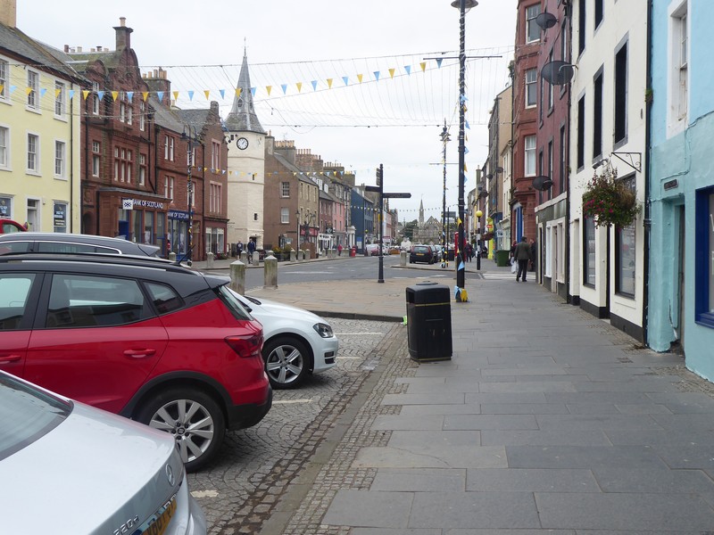
I was not hurrying because I planned to catch the first train of the day back from Falmouth to Perranwell, which was in a couple of hours’ time. While only encountering the odd car I dropped down into Penryn. The streets were almost deserted as I followed the Penryn River into Falmouth. The streets in Falmouth are quite strung out along the Fal estuary and seem to go on forever. I did manage to find a bakery that was just opening and what better way to celebrate my completion of the ‘missing gaps’ than a traditional Cornish pasty, expensive, but nice. Falmouth actually has three stations Falmouth Docks, Falmouth Town and Penmere, although to call them stations would be stretching it, more likely railway halts. Because I had time to kill I decided to walk to the furthest station at Falmouth Docks, the start of the line. None the stations have any ticket purchasing machines, so I spent the next 20 minutes working how I could purchase an online ticket through the Great Western App. The train arrived and departed on time, picking quite a number of people from the stations back to Perranwell.
So that is it. I have a single gap left to complete between Sandwich in Kent and Poole in Dorset. I have done a crude estimate that I would need about 20 days of walking to complete this. However, a large cloud looms over us all at the moment and there is no guarantee that the area I live in or the area where I intend to walk in will not be subject to future travel restrictions.
The Following Day: Old milestone near PenrynThe old National School in Penryn, National Schools were founded by the National Society for Promoting Religious Education.Following the Penryn RiverLooking across the Falmouth waterfront towards the docksDeserted streets in FalmouthThe railway terminus at Falmouth Docks
Distance today = 12 miles
Total distance = 6,333 miles
My last two remaining days in Cornwall while ‘tidying up’ my previous omissions of not walking around the estuaries of the Fal and Helford Rivers. Today was a simple affair which involved driving through the night to Helford Passage, just south of Falmouth. Here I would park just above the Ferry Inn at the local Parish Trust car park at a cost of just £1 for the whole day! Fantastic value given the cost of other car parks in the area.
I had deliberately slowed down on the drive down as my Satnav had given my arrival time a lot earlier than expected and I would have to wait until it got reasonably light to start walking. The sun was due to rise at 07:15 and I set off at 06:45 with hi-vis jacket and head torch on.
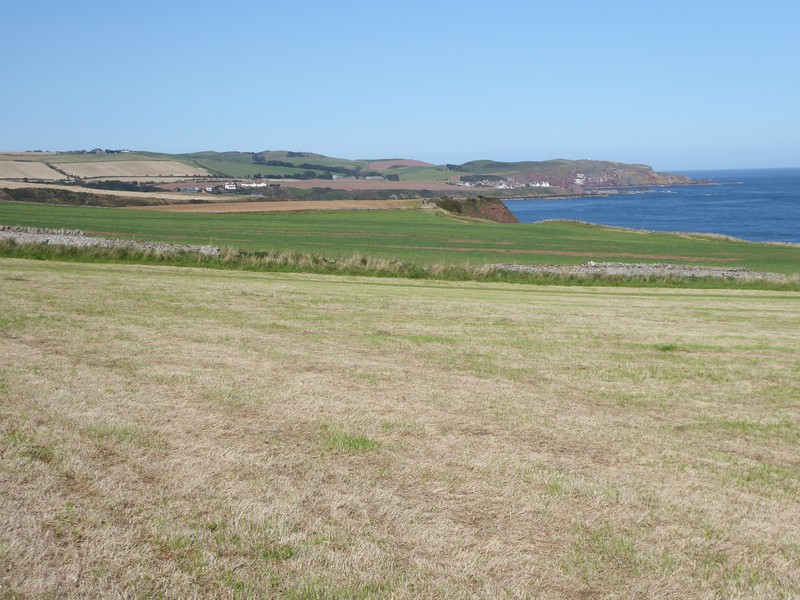
Most of today’s walk would along quiet roads, green lanes and a few footpaths. My route would follow a broad sweep around the Helford River and its many creeks and tributaries including Porthavas Creek, Polwheveral Creek, Polpenrith Creek, Mawgan Creek and Frenchman’s Creek. Because my route took a wide track it was difficult to actually see many of these creeks, in the absence of footpaths it would see me walking predominantly on roads which I hoped would be largely devoid of traffic.
One of the worst things about walking in Cornwall is that many of the quiet roads and lanes are sunken and are enclosed by high hedgerows or embankments with no path or verge, thus making any encounter with a car or tractor an experience! Fortunately, the roads I passed along were clear of traffic at this early time on a Saturday morning. Besides being hemmed in by the steep hedgerows, these minor roads rose and fell as I entered each new creek tributary. The bottom of these small valleys were also quite cold, with early Autumnal frosts not far away. Needless to say it was cold walking until the sun finally rose and heated everything up.
By the time I got to the first bridging point at Gweek, the temperature had risen quite sharply. Here I popped into a small convenience store to buy a Cornish pasty, which was not bad. After passing through Gweek, I was now walking on the southern side of the Helford River. I occasionally got a view of the river and its Creeks, but any good views were masked by the trees and high hedgerows.
At Mudgeon Farm I came to my first obstacle of the day; as I left the minor road to take a footpath across fields my heart sank as the intended footpath was in a field of maize 7 to 8 foot tall. Normally, you simply cannot walk through a crop such as this, but I decided to check to see if a path had been trampled by previous walkers, it had! I followed the path through the maize to the next field. At the stile my heart sank again as it was full of young Friesian cattle and they were very curious towards me. I could see that I would have to get through the next two fields with them in tow. However, I could see all the border hedgerows of the filed were very tight and there were no bail-out options. Normally, I don’t mind cattle, but inquisitive cattle can get up a head of steam and plough into the back of each other maybe taking you out. I retreated back through the field of maize in search of another route. Two miles up the road near Tregithew I was about to follow another footpath through a field until I noticed a freshly painted sign of a bull in the field. Normally I ignore these signs as they are rarely taken down and remain forever, even though the bull had since paid a visit to MacDonald’s! However, I saw the bull and stayed on the road.
When I reached the village of Kestle I dropped down to a wooded path which led into the village of Helford. I headed for Helford Point where the ferry across to Helford Passage landed. To summon the ferry I simply opened a board to form a large yellow circle which could be seen across the river. After about 10 minutes the ferry appeared. I caught the ferry with an elderly lady who was crossing over to visit the National Trust gardens at Trebah. All that remained was to walk up the steep hill to the car park.
Typical Cornish lane early on a saturday morningPassing around Porthnavas CreekLooking down on Porthnavas CreekLooking southwards down Polwheveral CreekCrossing over the Helford River at GweekThe Mawgan Cross an early Christian memorial stone to a man called CnegumusHeading through a field of maizeFrisky Friesians blocking my wayI was certainly not going to risk it with this bad boy!Entering the village of HelfordHelfordLooking across the Helford River to Helford PassageLooking down river towards the open seaSummoning the ferryOn the ferry across the Helford river to Helford Passage
Distance today = 12 miles
Total distance = 6,321 miles
The day had finally arrived when I would do my final coastal walk in Scotland and I knew it would be a tough one.
The overnight rest at my B&B in Berwick had certainly done the trick, my legs felt ok and I felt confident of taking on another gruelling day. I decided to make a very early start as the forecast was for a bright sunny day and I wanted to get some of the walk done before the sun was high in the sky. I parked my car at a small car park, just up from the pier in Berwick-upon-Tweed and then walked back into Berwick and headed for the railway station. I caught the 05:30 #253 bus to Cockburnspath. This service is run by Borders Buses, an offshoot from the West Coast Motors bus company across in Argyll. With their distinctive livery I thought they provided an excellent service and where probably my favourite carrier to date. I chatted to the driver before we departed, he was from Berwick, and was complaining that the Government had just put most of the NE of England, from Northumberland down to Teesside into local lockdown, due to a surge in Covid-19 cases. I was therefore quite lucky, in that, I would not have been allowed to travel and walk in the area later that day.
I got off the bus in Cockburnspath and it was still quite dark. Cockburnspath is a sort of path terminus for the start/end of the Southern Upland Way, the John Muir Way Link and the Berwickshire Coastal Path which I would be following off and on throughout the day. For the next couple of miles I was still using my head torch as I headed down to the large leisure/holiday homes complex at Pease Bay.
The climb up out of Pease Bay was very steep and because of the tight narrow road a wooden flight of stands was provided for pedestrians. I chose to walk along the road instead. I was heading for the old coast road which ran along much higher ground and provided the best views up and down the coastline. Far below me was Siccar Point, famous in geological terms for the site of Hutton’ s Unconformity, it was a long way down and a long way back up, so I carried on. I passed though the old hamlets of Old Cambus West & East Mains, then through Redheugh Farm where I gradually gained height south eastwards to the much higher ground of Harly Darlies at 230m. Here I picked up the Dowlaw Road, which ran towards the Dowlaw Farm. Dowlaw Farm offered camping for £15 per night, but I’m not sure what you actually got for your money as they called the payment a “donation”.
The walking after Dowlaw Farm was hilly sheep and cattle country, but the going was easy and up until now my legs felt ok. After passing some Admiralty Distance Poles, apparently used to measures nautical miles, the cliffs began to gain some serious height. When I came to Waterside Dean I descended steeply into a huge gully and then had to climb back up to 161m. It was quite a test on my legs and with the heat was tough going.
Walking down into Pease Bay at first lightLooking back northwards towards Torness Power StationWalking around Dowlaw DeanCrossing over Dowlaw BurnThe cliffs above Lumsdaine ShoreOne of the Admirality Distance Poles used to measure a Nautical MileLooking towards St. Abbs HeadHeading down steep slopes into Westerside DeanLooking towards St. Abbs Head
I was now able to look down on St Abbs Head, which was a lot lower than the ground I was on. The walk down to and then up onto St Abbs Head was not too bad. I was rewarded with great views both north and south along the Berwickshire Coast. As I descended towards the small fishing village of St. Abbs I met more walkers who were heading up to St Abbs Head. The red sandstone cliffs in the area were very impressive and with the path exposed, a trip could easily have dire consequences. I did not descend down to the harbour in St Abbs, as even small descents and consequential re-ascents is something that my mind is telling me not to do. I did pop into the tiny village Post Office where I bought more drinks to keep me going. However, between St Abbs and my next destination – Eyemouth there were numerous descents down to the beach and back up the cliff, which were becoming painful.
Eventually I came into the larger town of Eyemouth, which was quite busy. I popped into a co-op to buy further drinks, even though I was carrying plenty of water still. I have developed a taste for those iced coffee drinks, which tend to distract or take my mind off the complaining what my body is trying to tell me!
When I reached the village of Burnmouth I was joined by the main East Coast Rail line, this was quite important, as it marked the final section of the walk where the railway line, the A1 road and the coastal path were ‘pinched’ tightly together between the sea and the higher ground. I crossed under the railway line for the final time. As I passed Hilton Bay I saw a sign for a bothy down the cliffs towards the beach. I had a quick look but could only see the ruins of a cottage. At Marshall Meadows I passed through a gate and was back in England. The next 4 miles back into Berwick-upon-Tweed was certainly not a stroll, as I had 4 miles of quite painful walking with my legs and ‘chafing’. It was not enjoyable.
Back at the car I could sitdown, relax, change clothes and shoes and begin to reflect. I had started walking from Gretna back in May 2016, knowing that walking around Scotland was going to be the biggest challenge that my walk around the coastline of Great Britain was going to face and so it turned out to be. I had visited many many places that I had not been to on the hundreds of previous visits to climb hills and mountains. I also felt quite sad at finishing something that I, for the main, really enjoyed doing. I must also thank those fellow walkers on the ScottishHills site, where I also post my Scottish walks, who have lent advice and support during my quest.
But it’s not over, apart from two estuary walks in Cornwall, the remaining gap in my walk is between Sandwich (in Kent) and Poole (in Dorset) – 20 more walking days. But even as I write this the ugly head of potential lockdowns looms imminent for us all.
Heading down over easy pastures towards St. Abbs HeadLooking nortwards along the rugged Berwickshire coastlineAt St. Abbs Head looking northwardsLooking back towards St. Abbs HeadHeading towards ther village of St. AbbsLooking down on the village of St. AbbsHeading around Coldingham BayWalking along Pocklaw Slap towards EyemouthLooking back northwards towards St. AbbsEyemouth beachThe East Coast mainline appears at BurnmouthCliffs and ruined cottage near Hilton BayHeading south with Marshall Meadows in the distanceI had to force a smile for this selfie, as the legs were complaining big time!The final push into Berwick-upon-Tweed
NB: I also publish all my Scottish Blog entries on the excellent Scottish Hills website, I use the same narrative, but larger photos and a few extra ones. They can be found here:
My final two days of coastal walking in Scotland! I knew this was going to be hard as I intended to complete the remaining 50+ miles or so down to Berwick-upon-Tweed over two days.
As with most travel plans these days I had half an eye on potential local lockdowns due to spikes in covid-19 cases or the arrival of autumnal weather. Because I don’t do a travelling day now I had to try and get some sleep before I set off from Telford in Shropshire for the overnight journey to Cockburnspath, which is about 20 miles north of Berwick-upon-Tweed. However, I did not get much sleep in the end, but I knew I would sleep well that night.
Cockburnspath is the meeting place of two famous long distance footpaths, the Southern Upland Way which snakes over the hills across the Scottish Borders to finish at Portpatrick on the West Coast after 341km. The second path is the shorter Berwickshire Coastal Path, which I would be making use of on my second day of walking and which runs down the coast to Berwick. There is also a link extension path to the John Muir Way which runs north to Dunbar.
After parking in the village square in Cockburnspath, I caught the 06:27 #253 bus service to West Barns, just west of Dunbar. Here I waited for the 07:50 #120 bus service to North Berwick, where I got off at the train station.
At 08:30 North Berwick was deserted, although I did manage to find a Greggs open, so I nipped in for a coffee and sausage bap. I had a couple issues with trying to get out of North Berwick on various footpaths, but eventually got onto the A198 which had a footpath for most of the way. The elevated position ensured I had tremendous views across nearby Tantallon Castle and out to the guano covered Bass Rock.
After a short distance on the road at Auldhame I headed for the shoreline at Seacliffe Beach. I walked along the shoreline a short way before I needed to climb up onto the low-lying cliff line to pick up one of the numerous farm tracks which would lead me to Tyninghame. I passed an awful lot of Private notices which I ignored, as these were farm tracks I was walking along. Because of the River Tyne, the Scottish one, I knew I would have to divert inland. The whole area is part of the Tyninghame Estate and although there is a footbridge further east along the river, the bridge is in a poor state of repair. However, I did later find a recent photo of the bridge and it seemed ok to me; anyway the inland detour only amounted to an additional mile.
After crossing the River Tyne I joined up again with the John Muir Way which was returning from one of its many inland detours. I stayed on the John Muir Way into Dunbar, which incidentally was where John Muir was born in 1838 and has a local country park named in his honour. I wonder how long that will last in these days of retrospective examination of dead people’s words?
Early morning in North Berwick and a deserted High Street
Heading out of North Berwick along Milsey BayLooking back at North Berwick LawTantallon Castle with the Bass Rock behindThe Bass RockTyninghame HouseCrossing trhe River Tyne at TyninghameThe Tyne Estuary near DunbarHeading into DunbarZoomed shot from Dunbar looking 7 miles back to the Bass RockThe low tide bridge heading into Dunbar, where I got slightly wet feetA busy Dunbar High Street
After stocking up on more supplies I set off along the shoreline of Dunbar’s Golf Course. The course was very narrow and there were numerous signs warning of the dangers of getting hit by a golf ball. Actually, you don’t have to be a walker to get hit by a golf ball. In my golf playing days I was struck with a ball from my golf playing partner! The ball hit the soft fleshy bit under my rib cage and I could feel the dimples of the ball!
As walking along sandy grassy paths became very easy; both the lighthouse at Barns Ness and the Nuclear power station of Torness came into view. At Skateraw Harbour I passed some very well preserved limekilns, with the central shaft almost intact. To get around the power station there was an excellent footpath around the perimeter fencing, although, with most nuclear power stations there is nothing much to see.
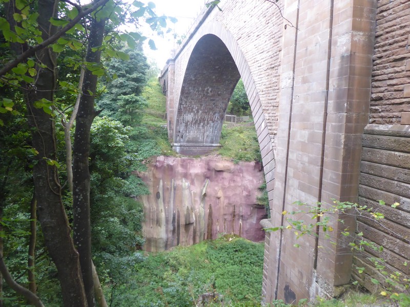
As I walked along the cliff top path I was joined, about 100 metres away by the busy A1 road and the main east Coast main rail line. When I reached Bilsdean Burn I had to lose all of my height and drop down to the shoreline, which was annoying. I carried along the shoreline for a while until I arrived at the huge Dunglass Dean ravine. The ravine is quite amazing and even though this was at the end of my walk and I was really tired this natural feature blew me away. Within a very small area there are four bridges, the closest to the sea is the current A1 dual carriageway bridge, then comes the old A1 bridge from 1932, then the railway viaduct and finally the bridge that I crossed over, probably the old coast road bridge. I walked underneath the first three bridges and picked up the Southern Upland Way. It was very difficult to get a photo that gave the depth and scale of the ravine, especially with the amount of summer foliage still around. After crossing the bridge I passed from East Lothian into the Scottish Borders region, my last in Scotland. All that was next required was a short walk into Cockburnspath.
A tiring day, but the legs were ok and I now looked forward to my final walk in Scotland.
Approaching Barns Ness lighthouseApproaching Torness Nuclear Power StationOld and new – the late 18th Century Torness LimekilnThe central shaft of Torness LimekilnHeading along the beach at ThorntonlochThe supports for the new A1 bridge over Dunglass Dean with the old 1932 A1 bridge to the rightThe railway viaduct over Dunglass DeanEntering the Scottish Borders
NB: I also publish all my Scottish Blog entries on the excellent Scottish Hills website, I use the same narrative, but larger photos and a few extra ones. They can be found here:
It’s been a while since I did any of my Use of Ferries walks. These are basically walks to fill in the ‘gaps’ left when I did the South West Coastal Path over 6 years ago and used local ferries to cross rivers and estuaries. Over the years I have been busy ‘filling’ in these ‘gaps’ to achieve a full walking record around the coast of Great Britain. As it stands I have two remaining rivers to complete, the Helford River and Falmouth River. I hope to get both of these walks done before the ferries stop in late September/October, as I still utilise the ferries to link the two walking points around the estuaries to the first bridging point.
The largest estuary walk would be the walk around the huge Falmouth Estuary, the third deepest harbour in the world and composed of a myriad of tributary rivers, creeks, inlets and pools. It would take two days to walk around.
Today I would do the first days walk around the estuary, although for logistical reasons, I would have to return for the second walk another time. The logistical reason being the unavailability of affordable accommodation in the area, £130 per night is not affordable in my book. This also meant a long day out from Shropshire, as the mileage to this part of Cornwall was 280 miles – one way!
The plan was to complete a very broad sweep around the numerous rivers and creeks avoiding the small peninsulas and promontories which had very few footpaths or right of way around them. I decided to make Truro, the County town of Cornwall, my end point for this walk, so that’s the place I headed for on the overnight drive down. I parked at Truro railway station, where parking was only £2.70 all day on a Saturday/Sunday; compared to a Council Car Park at £8.20 any day!
Another consideration for today’s walk was the route. Cornwall’s roads are notorious for their lack of footpaths and verges to safely walk along, in fact some of the roads have almost vertical high banks either side, with no escape or refuge from any traffic. As you can imagine, there are many tourists around at this time of the year, so avoiding the traffic was a key priority.
I decided to get the 07:22 #U1 bus to Falmouth and then pick up the water ferry to St. Mawes and then a smaller ferry onto Place, a small jetty on the end of the Roseland Peninsular. Both ferries were very busy, particularly the smaller Place ferry, where the number was restricted to 12 passengers at a time. Because this ferry was only 5 minutes either way, the ferry made a couple of trips to get the other walkers across.
After all the travel and planning I finally set off at 09:15 on a beautiful sunny morning from Place. I climbed up a well-trodden path up the hill towards the small village of Bohortha, here I joined public road. I continued undisturbed along the empty road to Porth farm. To my right, just 200m away, was the South West Coastal Path and of course the sea. From Porth farm I continued along a green lane which was also a bridle way. I met no one until I descended into the small village of Portscatho, which I walked through some 6 years ago. I retraced my steps along the SWCP a short distance through the village, but as the coastal path continued along the coast I took a minor road with only the odd car. By the time I reached the village of Curgurrell I had to turn inland away from the coast.
I continued along a series of twisting lanes through the hamlets of Treluggan, Treworthal, Trenestrall, Trelonk and Trethella before descending to the village of Ruan Lanihorne. Although I did not walk through the village but instead took a lower road alongside the River Ruan. The Ruan joined up with the River Fal, which I crossed over at the Sett Bridge. The Fal at this point was just a small river and emptied into an upper tidal estuary surrounded by wooded hills. The area was very secluded and quiet, apart from the odd walker and car; the whole area was a delight to walk through. I left the road again and took a bridle path that led to the hamlet of Gare, from there it was back to the twisty turning roads, albeit without cars.
I passed through the small hamlets of Little Tregerrick, Tregerrick and Carharthen before I started to hear the traffic coming from the A390 at Tresillian, where I was heading next. The traffic on the A390 was very heavy, but it was reassuring to have a footpath to walk along before I turned off the main road. The next mile along a minor road into Truro was horrible, as an accident on the A39 near to Truro had cars being diverted down to this small road I was trying to walk along. It was actually chaotic with cars unable to get past each other and me being unable to pass them either! At times I was actually standing in the road waiting to pass cars! I was glad to descend into Truro itself and head back to the railway station. I did not explore the City of Truro, perhaps I may do that on my next trip.
Apart from the chaos of the final bit of road into Truro, the walk had been wonderful, few people and even fewer cars made it a truly enjoyable walk and place to be.
Waiting for the St Mawes Ferry at FalmouthLeaving FalmouthArriving St. MawesLeaving St. MawesLooking northwards along the coast at Porth FarmLooking back at PortscathoPorthcurnick BeachLooking back at Porthcurnick BeachHeavy going near the Tuckingmill CreekAlmost hidden from view descending into Ruan LanihorneThe Sett Bridge over the River FalA Wheatear near GareWalking alongside the Tresillian RiverCrossing the River Truro in Truro
Distance today = 17 miles
Total distance = 6,257 miles
My third day of this walking trip and I have concerns about finishing the walk that would end in North Berwick. Yesterday my feet and lower legs ached quite badly which required me to stop five times to temporary rest them. As this was a Sunday I stayed with my tactic of walking very early towards my destination and then using public transport to travel back to my car. So at 05:00 I drove from my B&B in Leith to Prestonpans railway station where I parked.
As I set off from the railway station in the dark with head torch on, I felt my feet and legs to be perfectly ok. Even though today’s walk would be considerably less than yesterday’s walk I knew at some point the achy feet would come back.
The next 6 or seven miles would be predominantly on the John Muir Way, which also follows alongside the B1348 and both stick very close to the shoreline of the Firth of Forth. As it was still dark, my photos were very thin on the ground. I’m afraid I don’t have the skill or patience to set up my camera to take night time shots – I’m still basically a point and click sort of guy.
I passed out of Prestonpans and past the site of the former Power Station of Cockenzie, demolished some 5 years ago. By the time I reached Seton Sands the dawn had begun to break and I was able to switch off my head torch. I could still see the lights of the towns and villages across the Firth in Fife, on a lovely still morning. After passing Longniddry the coastline began to turn northwards towards Aberlady. As I rounded Aberlady Bay I left the road behind and headed across Peffer Burn via a wooden footbridge onto a vast expanse of land called Gullane Links. The links contain a number of golf courses and surprisingly the ground rises quite high here. I headed for the high ground, which gave an impressive view across to Fife, westwards to Edinburgh and to North Berwick Law and the surrounding area of East Lothian.
I purposefully headed into Gullane, a place I last visited some 46 years ago and a place where someone very special to me lived together with her family. As I stood and paused at the end of the road where they once lived I felt very sad. Distant memories.
As I left Gullane behind me the feet started to complain again, not painful, just ‘achy’ like they normally do after 10 miles of walking. I decided to stay on the road the remaining 5 miles to North Berwick. Although there is an excellent bus service running every 30 minutes, on a Sunday, back to Prestonpans I decided on catching the train; well I had parked the car at the train station in Prestonpans. North Berwick rail station sits at the end of a small single-track branch line which is linked to the main East Coast line. It has just a single platform and a waiting room, fortunately, there is a small booth where I could buy a coffee. I sat outside in the bright sunshine waiting for the first train of the morning. By 3’o clock that afternoon I was back home in my garden in Shropshire. Time to recover my achy body and feet and to plan the, hopefully, two walking days that will get me to Berwick-upon-Tweed
Early morning heading along the Firth of Forth just north of Seton SandsZoomed shot across the Firth to Kirkcaldy with both East and West Lomond on showWalking northwards along Gosford BayThe entrance to the grounds of Gosford HouseThe old Mercat Cross in Aberlady. Mercat Crosses represent a town or village’s right to hold a regular market or fairCrossing the Peffer Burn onto Gullane LinksZoomed shot westwards towards the Forth Bridges 22 miles awayZoomed shot across Aberlady Bay back towards Edinburgh from Gullane LinksLooking towards North Berwick LawThe ruins of the 12th Century Old St. Andrews Church in GullaneNorth Berwick railway station
NB: I also publish all my Scottish Blog entries on the excellent Scottish Hills website, I use the same narrative, but larger photos and a few extra ones. They can be found here:
I had based myself in a B&B in Leith for the two nights of this trip, at a fairly reasonable rate for city such as Edinburgh. I had already worked out how many miles I could clock up on two successive days of long distance walking, and decided that I should be able to reach Prestonpans today. Although after yesterday’s exertions I was a bit apprehensive about completing the distance.
I decided to drive to and park at the railway station in Prestonpans. I then caught the 06:26 train to Edinburgh Waverley, and then had a short walk to the end of Princess Street to catch the 06:57 #43 bus to South Queensferry. I got off the bus very close to where I had parked yesterday. Today was forecast to be a dry warm day with lots of sun, and so it turned out to be.
The old cobbled streets of South Queensferry were deserted when I walked along them and although a small place, seemed to echo a rich history. What I did have on this beautiful morning was an unobstructed view of the Forth Bridge (the railway one) and I decided that this bridge was probably my favourite bridge, it had close competition from the nearby Queensferry Crossing and a bridge, about 5 miles from my home – Ironbridge in Shropshire.
Today’s walk would follow off-and-on the John Muir Way. I followed a good track out towards Hound Point and then SE along Drum Sands. The surrounding forest soon gave way to the impressive Dalmeny House, home to the Earl and Countess of Roseberry. I cut across the private golf course and headed along the shore a small distance. Even at this early hour there were many people out and about, particularly cyclists. At some point I knew I would have to divert inland for almost 2 miles, as the River Almond crossed my path, making its way towards the Firth of Forth. After crossing the River via the old bridge close to the A90 I headed north. The walk along the banks of the Almond was brilliant, full of rapids, a weir and a gorge, the walk was beautiful. Eventually the Almond emptied into the Firth of Forth at Cramond. I always associate Cramond with the House of Shaws in Stevenson’s novel Kidnapped, and John Laurie (Ebenezer Balfour) appearing at the window with Blunderbuss in hand to confront his nephew, David Balfour.
The cobbled streets of South QueensferryThe Forth BridgeThe Forth BridgeDalmeny HouseHeading towards Leith along the Firth of ForthWeir on the River Almond near CramondThe River Almond flowing into The Firth of ForthThe low tide path out to Cramond IslandStranded fish on Cramond beach
The next section of the walk was along the Cramond promenade which was really busy with runners, walkers, cyclists, dog walkers and others setting off on the low tide towards Cramond Island. I did think about doing an out and back to the island, but with the long distance yesterday and still having a long way to go on todays walk I pressed on towards Leith.
The outer suburbs of Edinburgh began to appear, but I could see I was still some 4 miles from Leith. Eventually I passed the large marina developments of Granton Harbour and then onto the Port of Leith. The whole area is one of huge residential developments that are still ongoing. The busy road seemed to go on forever and I was glad when I lost the main road which had been with me for almost 4 miles now. I was rewarded with a glorious down onto the Portobello and Joppa beaches and the sweeping coastline of East Lothian heading towards North Berwick. I also began to see the appearance of road signs for Berwick-upon-Tweed; another reminder of the end of my walking journey around the Scottish coastline. The promenade in Portobello was crowded and I struggled to keep my social distance as I passed through the throngs. By the time I reached Joppa, I had taken 3 or 4 rests and my feet are starting to complain.
I pressed on and began to fade as the miles ticked on, by the time I crossed over the River Esk at Musselburgh I had taken my fifth rest, as I contemplated the fact that I’ve just crossed over into East Lothian, my penultimate County, with just the Scottish Borders still to come. I struggled into Prestonpans and slowly made my way up the hill towards the train station.
Another tough day of 8 hours walking, even though I stop 5 or 6 times the rests are not always helpful as it gets difficult to get the legs and feet moving again after stopping!
Granton Lighthouse – built in 1850 as a training lighthouse for the Northern Lighthouse BoardLooking down on the beaches at Portobello and JoppaBusy times on Portobello sea frontSilver Mussell sculpture at MusselburghCrossing the River Esk in Musselburgh
NB: I also publish all my Scottish Blog entries on the excellent Scottish Hills website, I use the same narrative, but larger photos and a few extra ones. They can be found here:
This could be my last 3 day walking trip to Scotland, as if all goes to plan I would reach North Berwick by the end of it, leaving two big walking days to Berwick -upon-Tweed, thus completing the Scottish section of my coastline walk around Great Britain.
Today’s walk would be a big day and I needed a very early start. To do this I had to get about 5 hours sleep the previous evening and then drive up to Edinburgh through the night. I planned to catch the 6:32 #x58 bus from the slip road on the Forth Road Bridge, this bus would go all the way onto East Wemyss. The drive up from Shropshire was quick, as travelling through the wee small hours usually is. I parked at The Binks, in South Queensferry and walked the half mile onto the slip road of the Forth Road Bridge. I was not surprised to hear the bus driver say it was £12.70 for a single fare to East Wemyss. That would have been the most expensive bus journey ever for me. However, on the Scottish Traveline site I had seen that a day return ticket would be just £8. I have still yet to understand why these fare pricings are what they are!
Five minutes after getting off the bus in East Wemyss, the rain started and within 10 minutes I was soaking wet. The heavy rain shower was not forecast, which made me a bit annoyed. At least the walking was easy as I passed below Wemyss Castle, along the shore side Fife Coast Path.
I soon came to the first real built up area which was the old mining community at Dysart and the long since closed Frances Pit. The only visible remnants of this mining town were the info boards and the old winding gear. I passed around its charming little harbour and through a small tunnel which led to the shoreline. I passed by the ruined Ravenscraig Castle and came into Kirkcaldy. The rain returned again and I received a second soaking. I decided to get some respite from the rain by popping into Lidl to get some pastries. The walk through Kirkcaldy was easy along the wide sea front promenade.
Dawn at The Binks, South Queensferry looking across to FifeLow tide at West Wemyss harbourLooking south down The Firth of Forth at Chapel Wood TowerThe old headframe at Frances Colliery, DysartSt. Serfs Tower and Church in DysartRock tunnel towards Ravenscraig at Dysart harbourLooking down on Pathhead Sands and Ravenscraig Castle
The sun eventually came out as continued south along the shoreline path into Kinghorn, here I had to divert inland slightly to get around the railway. Edinburgh was now becoming larger in my sights across the Firth of Forth as I followed the railway line into Burntisland. After walking through the town I re-joined the railway line along the Fife Coast Path. I passed along the steeply wooded area known as the Heughs, which displayed a number of recent landslides, with evidence of a small foot bridge being swept away. The next small town I came to was Aberdour which seemed to contain a number of “private” streets and looked to be “very well to do”. Here I had to divert inland to get around an oil terminal to the south, alongside a golf course.
The rain returned again as I entered the really posh areas of Dalgety Bay, fortunately I had not dried out from the last deluge so I did not get as wet this time. I could now make out the three bridges quite easy, as I left Dalgety Bay behind and pushed on into Inverkeithing. I was now beginning to feel the effects of the long drive and the equally long walking mileage. I decided to give North Queensferry a miss and head straight for the Forth Road Bridge. I was now getting slightly nervous now as the wind speed had been building for a while now, although, I was sure the speed was less than the 50mph it needed to be before pedestrians were not allowed on the bridge.
By the time I reached the approach to the bridge warning signs had restricted the Queensferry Crossing (the Motorway Bridge and which I had walked over back in 2017) traffic to 40 mph. The speed on the Forth Road Bridge was a more sedate 20 mph, which the permitted traffic of buses, taxis, motorbikes obviously were not adhering to. It was certainly a unique setting to have these great bridges grouped so closely together. As I walked over the bridge I was surprised at how low the perimeter guard rail was and the huge drop to the water below. The length of the bridge is just over 1.5 miles long and I was really pleased to finally reach the far side. After crossing the bridge all that remained was to complete the short walk back down to South Queensferry and my car. I had been walking for 9.25hours and I was quite fatigued.
Seafield Tower between Kinghorn and Kirkcaldy, abandoned in 1733Looking down on the sea front at KinghornZoomed shot down The Firth of Forth to the three bridges. Notice the wind speed has picked upZoomed shot across the Firth to Arthurs Seat, Salisbury Crags and LeithHeading into BurntislandLooking down on The Hawkcraig Point Leading Lights marking the deepwater channel from the east end of Mortimer’s Deep to the Forth Deepwater Channel, used by LPG tankers leaving the nearby Braefoot oil terminalThe ruins of St Bridgets KirkIn the late 18th and early 19th cenbtury this small stone building adjacent to the kirk graveyard was used by relatives watching over the graves to ensure body-snatchers did not steal those recently buriedLooking across to the Queensferry CrossingLooking back to the Queensferry Crossing from the Forth Road Bridge
NB: I also publish all my Scottish Blog entries on the excellent Scottish Hills website, I use the same narrative, but larger photos and a few extra ones. They can be found here: