221. Skye: Elgol to Skye: Glen Brittle

Today would be a special day and unique day. Not only would I be re-doing a walk that I did 42 years ago in the summer of 1976, but I would also be accompanied by Malky, a friend and fellow contributor on Scottishhills.com. Malky has a great depth of knowledge of walking in the UK, particularly Scotland and is famed for his inventive routes using bike and boot over great distances. However, it almost did not happen. We both  agreed to meet in Glen Brittle. I positioned my car outside the campsite close to the public car park and waited for Malky to appear. Unfortunately, by 9:30 the effects of a really hard day and a bottle of beer had me ‘zonked’ out. Little did I know that Malky had gone all ‘hippy’ on me and was off climbing a nearby Marilyn – Arnaval to see the Solstice sun setting. Malky therefore did  not appear in Glen Brittle until after 10 in the evening. The following morning meant with the absence of a phone signal I had to think about a different route. I drove to Broadford and prepared to get a bus to complete another route. Just then Malky called  and the walk was back on! Turns out Malky was parked only 20m from me, but neither of us bothered to ask what vehicle the other was driving!! Dohhh! Anyway, we left Malky’s car in Glen Brittle and set off in mine for the long drive around to Elgol.

A quick brew in Elgol and we were off. We would be following a cliff-top path towards Camasunary which offered great views of the Cuillin across Loch Scavaig. The narrow path is exposed and a simple trip could be fatal; only 3 weeks before a man had fallen to his death from this path. Most of the Cuillin ridge was still in cloud, but we thought that may lift by the time we got around to it. At Glen Scaladal we dropped down to the beach and were able to continue on the rocky foreshore around a headland. We arrived at the new bothy in Camasunary and went inside. A young American couple had spent the previous night there.

I remember very little of my walk from August 1976. I do remember the long walk in from Broadford, in the rain and then arriving and camping close to Camasunary house and drying my clothes with a large fire while sitting on a Walkers of Mallaig fish box!

Looking back to Elgol
Looking across Loch Scavaig towards the Cuillins
The bothy at Camasunary
Towards Sgurr na Stri at Camasunary 2018
Me enjoying a cuppa at Camasunary – 1976

We headed for the stepping-stones across the Abhainn Camas Fhionnairgh and continued along the rough path around the southern nose of Sgurr na Stri. A couple of girl runners caught and passed us, they were getting the boat back into Elgol. As we  arrived at The Bad Step, we heard a right “kerfuffle”  from the cliffs above us. It looked like a couple of Common Buzzards either defending or attacking a nest/young from crows. I tried to get a telephoto shot but it was too difficult. The Bad Step is not bad at all, and I remember nothing about it from when I originally crossed over it. We passed onto the head of Loch Coruisk and met about 20 people who had been brought in by the boat from Elgol – The Bella Jane.  Personally, I think it is such a good thing that  people who perhaps are unable to walk into Loch Coruisk, can experience this magical setting, to be delivered right into the heart of the Cuillins, to be surrounded by mountains.

We headed up into An Garbh choire and were heading for the bealach just to the left of Caisteal a’ Garbh-choire, a large tower of rock. As we got higher into the Coirie, the wind picked up and it became much colder. I put my jacket on, while Malky stayed just with his tee-shirt, iron-man! We could see evidence of a number of recent large rock falls. Some of the boulders within the rock falls were huge, almost the size of a house! Lets hope nothing gets dislodged today! The route up the coirie was in a series of stages and levels which seemed to drag on forever. By the time we reached the final stage of the boulders below the bealach, I was flagging. Yesterdays efforts had drained me somewhat. We topped out on the bealach amidst the clag. The wind was very fierce and we did not linger.

Rounding Sgurr na Stri and heading towards Loch Coruisk
Buzzard defending nest on Sgurr na Stri
Approaching The Bad Step
Looking up the An Garbh choire
Looking across Loch Coruisk
Looking back down An Garbh choire towards Sgurr na Stri
Large landslide boulder in An Garbh choire
At the Bealach a’Garbh-coire

We dropped down the short distance into Coirie Ghrunnda and walked around the small lochs. The next section of the walk was quite tricky and meant keeping to the right of the coirie wall to pick up a path. However, we went down a number of false trails where people before had climbed down small sections only to have to back-track. We descended a couple of sections where we also had to back track before we picked up the proper path. The clag had now cleared and we could now look out towards the coast and the Isle of Soay. The geomorphology of this section was created by large glaciers scoring the underlying rocks into smooth curvaceous slabs, which dropped down in a series of stages. Care was still required, as a trip here could be fatal. Eventually we lost height and dropped down to a more recognisable path. Parts of the Cuillin Ridge had now begun to clear. The walk back to Glen Brittle was covered quite quickly.

We then had to do the long drive around back to Elgol and collect my car. However, all great walks should end with a fish supper, so we stopped off in Broadford and called in at the Chippy. In typical Malky fashion, after dropping me off in Elgol, he headed up Ben Meabost, a small Marilyn close to Elgol.

Heading down into Coire a’Ghrunnda with Isle of Soay in background
Heading above slabs in Coire a’Ghrunnda
Slabs in Coire a’Ghrunnda
Looking back up the slabs in Coire a’Ghrunnda
Approaching Glen Brittle

A great and memorable days walk. Once again cheers Malky for the company.

NB: I also publish all my Scottish Blog entries on the excellent Scottish Hills website, I use the same narrative, but larger photos and a few extra ones. They can be found here:

http://www.scottishhills.com/html/modules.php?name=Forums&file=viewtopic&t=24194

Distance today = 14 miles
Total distance = 3,946 miles


220. Skye: Drumfearn to Skye: Elgol

After finally sorting my garage roof out, it was time to do some more Scottish coast walking. I had planned to do three days of walking, but in the end managed to combine my first days walk with the planned second into one long walk. I was also looking forward to trying out my new, much better camera, on the Scottish landscapes.

I set off from Shropshire in the early evening hoping to reach  Fort William before pulling over and getting some sleep. I have found driving during the daylight hours and early evening until about midnight, then sleeping for 5 hours, gives me much better sleep. I still had 104 miles to go which I would quite easily do if I set off about 5:30 the following morning.

I drove and parked in  Elgol and then set off on the 18 mile bike ride around to the A851 near Drumfearn. I hid the bike behind a mossy knoll and set off across a trackless boggy moor. I had opted to wear my ‘leaky’ boots, as I wanted to keep my good boots dry for tomorrows walk. Within 10 minutes  my feet were wet! The good thing about wet feet is that your feet cannot get wetter! So when I came to Abhainn Ceann Loch Eiseoirt, which feeds into Loch Eishort, I simply walked across. The tide was well out so I was able to keep close to the shoreline and I made good progress over the kelp-covered rocks.

In less than an hour I reached the small hamlet of Heasta, situated at the end of a 5 mile road from Broadford. I continued past the few houses just as it started to rain. I managed to pick up an old ATV track, which I followed for a while, until it disappeared in a different direction to one I was going. I continued over the trackless open moor until I could look down on the ancient township of Boreraig. Boreraig was forcibly cleared by the agents of Lord MacDonald to make way for sheep in 1853. There were 22 households here, scattered about the low-lying land and but now covered in bracken.

I managed to pick up the good footpath that draws many walkers to do a large circular walk linking Kilbride, Suisnish and Boreraig. The path runs  blow the  length of the impressive cliffs and crags of Creag an Daraich. As I walked along the path I noticed some movement on the shoreline rocks. It was an Otter. I quickly got my camera out and used the telephoto lens to get a remarkable close-up of the Otter. I tried getting closer, but it retired into the water and it was difficult to get any other shots. With my old camera it would have been impossible to get a decent photo.

I soon arrived at Suisnish, another village that suffered the same fate, at the same time as Boreraig. I picked up a good track which led me towards Torrin. As I admired the amazing views across to Bla Bheinn I noticed the underlying geology had changed and I was now walking over grey and white Limestone, or to be more precise the metamorphosed version of it – Marble. I had now left Loch Eishort and was heading towards the head of Loch Slapin, passing through the small scattered village of Torrin where I noted a small quarry, famous for its Torrin Marble.

Heading over trackless boggy terrain towards Loch Eishort
Heading along the shore of Loch Eishort
Aproaching the hamlet of Heasta
Looking down on the ancient township of Boreraig
Ruins at Boreraig
Looking back at Boreraig
Sea Otter below Creag an Daraich
Looking back at the cliffs at Creag an Daraich
Looking back up Loch Eishort
Looking down on Suisnish with the Cuillins and Bla Bheinn in the background
Looking across Loch Scavaig towards the Black Cuillin

I continued around Loch Slapin along the B8083, until I came to a turning for Drinan, which had a minor road running towards it. The road ran out and I continued along a good track, which eventually merged into another road which ran towards the small hamlet of Glasnakille. Another minor road led up the hill and continued for 2.5 miles towards my end point at Elgol. Elgol is the main village of the area and sits at the end of the Strathaird Peninsula. There were wonderful views to be had from its top car park out to the Small Isles and across Loch Scavaig towards The Black Cuillin.

The Black Cuillin from Elgol
Looking down on Elgol harbour

NB: I also publish all my Scottish Blog entries on the excellent Scottish Hills website, I use the same narrative, but larger photos and a few extra ones. They can be found here:

http://www.scottishhills.com/html/modules.php?name=Forums&file=viewtopic&t=24192

Distance today = 24 miles
Total distance = 3,932 miles


219. Barton-on-Humber to Stallingborough

Well I’d finally bitten the bullet and bought a ‘decent’ camera. At over £200 it is the most I have ever spent on a camera. The compact digital  I bought can do lots of things, but I have it set to Intelligent Auto mode at the moment, which means  I can  just point and click. I’ll try to learn the other features as I go along. I had decided on just another single day out to the east coast, as I had been preoccupied in doing substantial structural repairs to my large garage roof over the last two weeks.

I would be heading east along the Humber Estuary which meant having to contend with a lot of industrial areas. I had read other reports of people confronted by high fences or blocked off paths around these areas  and so I looked to take a safe and trouble-free route. I could see from Google Street Maps that an Oil refinery, Power Station, Docks, Quays and other industrial premises prevented easy passage eastwards. There was also the A180, which although looking good as a direct route into Grimsby, was a high-speed dual carriageway without a verge in places. I opted therefore for a safer and more sedate inland route.

I drove to and parked in the Station car park at Barton-on-Humber. Because this was a Sunday I had decided to walk to my end-point and get a train back to Barton. I set off at 06:15 and immediately headed for the grassy footpath that continued eastwards along the Humber. Although it had rained the night before the grass was remarkably dry, which was good because I had only my walking trainers on. It was grey and overcast, with a occassional breeze, great walking weather.

As the Humber Bridge receded into the distance I came to my first physical obstacle, the small creek of Barrow Haven. A footpath, alongside the railway crossed the Creek. I then had to head through a large lumber yard. A Public Footpath finger-post pointed through the yard, but the main gate was padlocked. Fortunately there was a small pedestrian side-gate that I passed through. As this was a Sunday the yard was empty , but on a weekday I should image it would be quite busy.

My next obstacle was the industrial area of New Holland. Again the path turned inland and followed a fenced road towards the railway crossing and the docks/factory entrance. Again the main entrance gate was locked but a open side gate allowed access to walkers. I followed the pedestrian markings on the ground through the site. However, I came to another locked gate and wondered how I could proceed. Fortunately, I had missed a wooden footpath post 10m back, which lead me down an overgrown path back onto the shore.

I continued to follow the footpath, called the Nev Cole Path, although this seemed to have been written on the occasional marker post in a marker pen! As the Oil Refinery and docks drew closer I knew the point where I needed to move onto road approached. At East Halton Skitter I transferred onto a minor road, which I would be on for the next 5 or 6 miles. I had only gone half a mile down the road when I came across a dead snake on the side of the road. It was a grass snake and it had been run-over. The snake was well over 1 metre long and was probably a female. Only last month, on Skye, I had found a small Adder which had also been run-over.

Low tide at Barton Haven
Looking back at The Humber Bridge
Barrow Haven
Walking through the timber yard at Barrow Haven
On the “Nev Cole Way”
Hull waterfront
Female Grass Snake – road kill victim

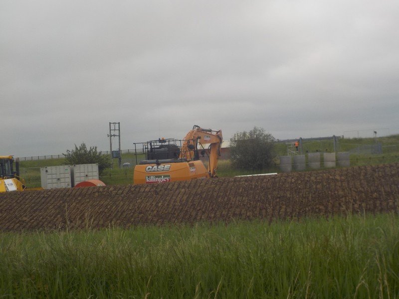
I continued along a dead straight road through East Halton, North and South Killingholme. At South Killingholme, I could see a large amount of groundworks going on. One of the workers told me these were underground cables for a Wind Farm, which was obviously linked to the Hornsea Project One Wind farm – a huge and ongoing development.

I headed down a B road towards the small village of  Habrough. There was no footpath, but the verge was ok. I had previously decided to turn towards Immingham , but decided that I would continue into Habrough and head towards the railway line. I crossed over the busy A180 and could see that it was not safe to walk along. At Habrough station I popped into the nearby Station Inn for a quick pint of Bateman’s Centenary RAF Ale. I don’t normally drink during a walk, but as I had just 3 miles to go to the end of my walk, so I thought why not?

The last three miles of the walk was a good grassy footpath that lead in a dead straight line alongside the railway line all the way to the small village of Stallingborough. I had 15 minutes to wait for the train back to Barton-on-Humber.

Incongruous setting – North Killingholme Church against Power Station
Crossing the A180
Looking back at the Station Inn at Habrough
Looking across fields of wheat and the A180 towards Immingham Oil Refinery
On the path towards Stallingborough at the Goxton Sidings crossing against a moody Lincolnshire sky

Distance today = 21 miles
Total distance = 3,908 miles


218. Thorngumbald to Barton-on-Humber

A quick one day visit to the East Riding of Yorkshire. I am quite excited about this section as it will see me achieve a number of firsts and milestones. I would  be leaving Yorkshire and crossing over into Lincolnshire, as well as walking through Hull, a place I had never visited before. Perhaps the highlight would be the walk over the Humber Bridge, a bridge that I had never crossed over before this day.

I set off early and made excellent time to Barton-on-Humber, which sits just below the Humber Bridge on the Lincolnshire side. It is a sleepy little town and I was able to park close to the railway station. I caught the “Fast cat” #350 bus into Hull. The bus seemed to take an age as we had to keep on waiting to keep on time with the published timetable. I got off at Hull railway station, which is also where the main bus station is. I caught the #77 bus towards Withernsea, and sat on the front seats of a double-decker, something I had not done for years. I got off at the village of Thorngumbald and popped into the local Spar shop for a few supplies. I had to start at Thorngumbald because I was prevented from continuing along the seawall on my previous trip because of ongoing works. I picked up the quiet road to the village of Paull.

Close to Paull Holme Nature Reserve I passed a number of newly constructed gas installations, I could also see the work on the sea wall that had caused my diversion to Thorngumbald. The footpaths marked on my OS map have long since disappeared amid the high security fencing of the gas processing plants.  Soon after I left the road and I headed down a track which took me onto the seawall. I passed around the historic Fort Paull, the historic Napoleonic battery fortress which is now a museum and houses a huge Blackburn Beverley Aircraft (a former heavy-duty transport plane used by the RAF). I could see the huge tail fins of the aircraft, but nothing of the rest of the museum which was hidden by trees. I entered the small village of Paull and was surprised to see at least three pubs, very close to each other. I left the village and got onto the sea wall again. I met a dog walker and struck up a conversation with him, he was the former mayor of Hedon and he gave me a brief history of the area.

Work on the sea wall at Holme Paull
The old lighthouse at Paull
Iconic KCOM telephone kiosk

I reached the outer industrial area of Hull and began the long straight walk along the very busy A1033. I was separated from the dual carriageway, which had no verge and continued along the dual cycle/footpath. I passed a number of cream telephone kiosks which are a throwback from when Hull or should I say Kingston had its own independent municipal telephone network (now privatised).  I started to count roundabouts, as this was the only clue to know where I am and where I needed to get back to the Humber shore.  Shortly after passing HMP Hull I headed across the dual carriageway and onto a new shore side housing development, now on the site of former Victoria docks. I passed around a very striking building, similar to the prow of a large ship, this was the Deep a large aquatic centre. I passed through the old part of Hull, with its cobbled street and continued onto the Albert Dock.

I had to look carefully for a footpath that would take me onto the Albert Dock, which I managed to find. After crossing a lock gate I followed high palisade fencing that guided me through the docks and onto a high gantry where I was able to look down at the ships and quays. This was really great because most of the time I pass around docks I have had to keep to industrial roads, here I was able to walk  through on high. I kept on the path which was sandwiched between the docks and the estaury. The Albert Dock gave way to the St Andrews Quay, which is now a huge out-of-town retail park alongside the A63.

Where the “bad boys” go – HMP Hull
The Deep

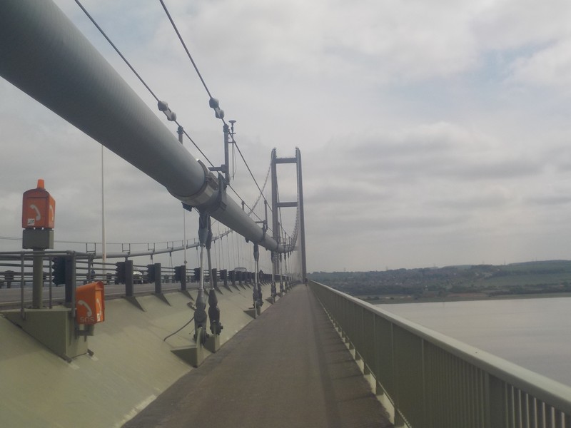
The footpath became very overgrown with grass and ran alongside the A63 into the village of Hessle. I pick up the start of the Wolds Way and pass underneath the Humber Bridge. It was very busy in this area, with a small beach and the Humber Bridge Country Park. I had to climb quite steeply up through tree-lined paths to get onto the bridge itself. The sun which had been hidden behind clouds for most of the day now made an appearance. It seems the eastern footpath of the bridge was closed so I was confined to the western footpath. The bridge itself is a outstanding achievement in engineering and an impressive sight.  The bridge was very busy with walkers and cyclist alike, admiring the brilliant views. I reached the far side and entered Barton-on-Humber in Lincolnshire. A great days walk with the passage through the docks and the crossing of the Humber the two main highlights.

The Albert Dock
Heading along the Albert Dock
Wolds Way marker at Hessle
Underneath The Humber Bridge
Crossing the Humber
About mid-way across
Looking back
End of the line at Barton-on-Humber

Distance today = 20 miles
Total distance = 3,887 miles