351. Selsey to Fishbourne

With family commitments and an impending matter of a football game against Italy on the horizon I decided I could just about fit a single days walk in on the south coast. I reasoned that traveling there and back on a Saturday should see lighter traffic and so it turned out to be.

Today’s walk would essentially be around the large peninsula of land with Selsey Bill as its southern promontory. I looked at the free parking possibilities and decided at a half way point of walking into Chichester to catch a bus and where I would finish today’s walk. After parking close to Chichester College I walked the mile into Chichester and caught the 07:05 #51 bus to Selsey, it being a Saturday I could use my Bus Pass. I must admit I have not used it as much as I would like, as most of my bus journeys occur before 09:30, the watershed after which the Pass is accepted.

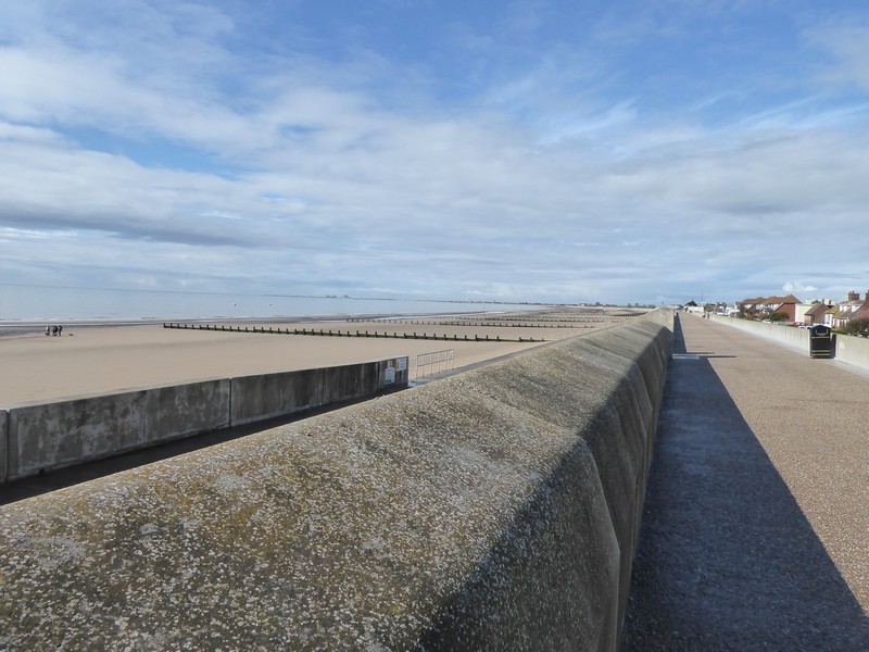
The weather forecast for the day did not look good and I accepted that I was going to get wet. It turned out that it rained lightly for virtually all of the walk and I kept my walking jacket on the whole time. However, the big plus was that it was warm. In fact, as I continued my walk along the sea front of Selsey, bathers were in the water while the rain fell. It was also very gloomy and overcast, so again along this part of the coast I had poor and restrictive views and visibility. As the tide was well out I managed walk around to Selsey Bill. From the west side of the peninsular I could just about make out other land forms in the mist that were seemingly the Isle of Wight and the body of the water before me the start of The Solent.

From my maps and reading other trip reports I knew I had to begin heading inland as like Pagham Harbour I needed to circumvent the large Nature Reserve of Medmerry. In the past it had been possible to walk along the coast, but an intentional breech had been made in the shingle shore allowing a deep fast-flowing stream called the Broad Rife to pass into the sea. The paths, tracks and roads are poorly presented on the OS maps, so I used the Google Maps satellite view to plot a way around the Reserve.

Heading along a very wet Selsey sea front
At Selsey Bill
Looking over Medmerry Reserve from one of the few look-out points

After an hours walk I emerged back on the shoreline at Bracklesham and continued on towards East Wittering. Atop the shingle beach there was no sea wall or compacted shingle to walk on, so I descended down onto the beach to pick up a good line of firm sand to walk along. The shingle began to disappear and the beach broadened out to become quite flat and a darkish grey colour. The presence of a huge car park  meant the beach was quite busy with many paddle boarders,bathers and  a few beach parties. The light rain continued to fall, but because it was still quite warm, nobody seemed to mind.

Back on the coast at Bracklesham
Heading along the beach at East Wittering
Paddle boarders near East Head

I knew I would soon come to the entrance to the Chichester Harbour, a huge natural harbour of special scientific interest as well as an area of outstanding natural beauty. I could have continued out to the spit of East Head but decided against it and continued  along an excellent shoreline path, which formed part of the New Lipchis Way. The word “Lipchis” is an acronym for the path which runs from Liphook in Hampshire down to Chichester and then onto East Head. I continued along this path, which with the rain had become quite muddy. On my left Chichester Harbour had become full both with a flowing tide and hundreds of small pleasure craft. It did not take long to get to West Itchenor, a small village with boatyards, jetties and a pub.

Looking across to East Head spit and Chichester Harbour


This Oak tree caught my eye with its central core rotted away but still very much alive!
On the New Lipchis Way

I walked through the village, past really impressive and expensive houses on the shores of the Chichester Channel. I arrived at Salterns Lock in need of some refreshment, so a cup of coffee and slice of walnut cake went down a treat. I was able to consume these refreshment at my leisure as I intended to cross over the locks of the marina. However, the gates to the marina were left open, as this was a period  of “free flow” in and out of the marina i.e. the water level in the marina and harbour were the same. After about 15 minutes the lock gate was closed and I was able to cross and continue northwards. At Dell Quay, I followed the Fishbourne Channel for the final 1.5 miles into Fishbourne.  I emerged on a very busy A259 and walked another mile or so back to the car.

Boatyard at West Itchenor
Spooky life-size statues in a private garden at West Itchenor
On the lock gates of the old Chichester Ship Canal
A boat passing through the lock into the harbour during “free flow”
The Crown and Anchor at Dell Quay
Rounding the end of the Fishbourne Channel at Fishbourne

Distance today = 20 miles
Total distance = 6,508 miles


Commemorative Platters/ Bowls/ Vases: Update 2

Well things have moved on since my last update. I went to collect my headstock from Preston and fitted back onto my lathe. The lathe is working perfectly and I have begun ‘rough-turning’ the pieces of green timber. It would have been quite dangerous to turn these pieces without having to control the speed that they turn at.

I created a number of truckles ranging from 14” to 20 “ and have mounted them on chucks and begun to rough-turn them. This means turning them into a shape that will approximate to what they may look like at the end of the process. The wood I am turning is ‘green’ and has a very high moisture content i.e 32%. It means when the piece begins to rotate at speed, centrifugal force throws water out and my face shield resembles a car windscreen in the rain! The good news is that turning ‘green’ is quite enjoyable as the turning tools create nice long spiral shavings . Once I have a platter / bowl  roughly in a shape that I want, I need to dry it out. Its starting off at 32% and I need to bring it down to about 10 – 11% before I make the final cuts. It would take years for these pieces to dry naturally, so I use a Wood Kiln converted from a Beko Freezer. With a 2” hole drilled in the base to allow air and a similar sized hole at the top acting as an exhaust. To get the air circulating I need to heat it up and I do this by the old incandescent light bulbs which can be still bought online. I have been using a 100watt bulb and this really gets things going. Although I could use the moisture meter to measure the drop in moisture content, it is not that accurate for thicker wood. The only solution is to weigh the roughly turned piece regularly, noting any weight  loss.

What I am looking for as the wood dries are  minute cracks which I will apply CA (superglue) to – it stops the crack developing. One thing that I cannot control though is the warping and deformation of the shape of the bowl as it dries out. This is the reason for rough turning and leaving sufficient ‘meat’ on the wood to get it back into a round shape.

So as it stands at the moment I have rough turned about bowls which are slowly drying.

On the fund raising side my wife and I have selected 9 charities that we would like to benefit from the sale of these crafted articles. They are:

i) Cancer Research UK – I have lost friends and family to this terrible disease over the years

ii) Oxfam

iii) Muscular Dystrophy UK – My young nephew Jamie died from this muscle wasting disease

iv) Lupus Research UK – Our son Matthew died from this disease in 1998, he was 11 years old

v) Alzheimers Research UK

vi) British Heart Foundation

vii) Donkey Sanctuary

viii) Severn Hospice – a local charity offering hospice care

ix) Cinnamon Trust – a charity that helps terminally ill people with the care of their pets

I have contacted the charities involved and have received very positive feedback and guidance. Although my efforts will not raise great sums of money, I feel I am contributing by making something that people will want to buy and thereby supporting these charities.

Below are some photos of what I have been talking about and I will keep you informed of my progress on and off the coast!

A truckle on the lathe ready to be turned
This is the completed base of the platter, the small hole in the centre is the mortice where the chuck will be attached when I turn the bowl around
The platter has been turned around and is ready for ‘scooping’ out the top of the platter
This is the completed ‘rough-turned’ platter ready to dry-out
My old Beko freezer, now a wood kiln. The incandescent light bulb can be seen at its base. The wooden boss sticking out of the bottom of the platters is simply to stop warping as the platter dries and are removed when the platter is ready for final turning
This is a rather tall wooden rough-turned vase that cannot fit into my kiln. Its so big I had to cut it in half to remove the inner wood. The glue line will be disguised when I do the final turning which could be awhile yet!
This is a 19.5″ rough-turned platter that is currently drying out in the Kiln, I have placed it against a large dinner plate to show how big it actually is
This will be my ‘burned in’ logo for all of the pieces that I craft for this project

350. Littlehampton to Selsey

On arriving at my accommodation, a pub in the village of Findon, I noticed a range of beers on tap which I had never heard of before, so after dumping my bags in the room I popped downstairs for a quick pint. The bar was empty so no covid-catching worries. This was the first time I had been in a pub since 2019 and the pint of Harvey’s Sussex Best went down a treat!

I made a very early start the following morning, leaving the accommodation at 04:15, as it was almost 30 miles to drive to the end of my walk in Selsey. There was thick fog which would be with me for most of the days walk. I intended to use the large car park at East Beach, at £1.70 for the day it was a fee I didn’t mind paying. Unfortunately, the barriers were down and it seemed the car park was not open until 08:00, but I managed to find free roadside parking close to the car park and was able to catch the 05:22 #51 bus into Chichester. I did not have to wait long for a #700 bus on towards Littlehampton.

I got off the bus at the railway station and promptly got a cup of coffee and walked the short distance to the footbridge over the River Arun. Here I sipped  my coffee while looking  down the River Arun on a very foggy morning. I followed the Arun on its western bank for a short distance cutting across a golf course towards the coast.  I followed a compacted shingle path of sorts before emerging onto the promenade leading into Bognor. I passed the Butlins holiday camp with its characteristic big-top tents that I had seen years ago in Minehead. The pier at Bognor was a bit underwhelming after passing Eastbourne’s and Brighton’s piers, although it had been shortened after fires ravaged the buildings in the past.

The footbridge over the River Arun at Littlehampton
An extremely foggy and murky morning looking down The Arun
Back on the shoreline with limited views
Breakwater sea defences at Middleton-on-Sea

It did not take long to walk along Bognor’s promenade and I soon had to get down on the beach to avoid the loose shingle. I continued along the foreshore until I needed to head for Pagham. Pagham Harbour is not really a harbour but a large tidal inlet that is a large Nature Reserve and RSPB site. There is a good footpath all the way around the periphery of the harbour and I met many bird-watchers with mega-zoom lenses attempting to get that perfect shot. I passed through the small village of Sidlesham Quay. After crossing a sluice gate I now head down the sea bank on the far side of the Harbour. As I approach close-by Church Norton I meet other walkers who had used the small nearby car park. I also came upon a portable gazebo sort-of-tent with a small group of RSPB volunteers trying to get passers-by to sign up to a subscription for the RSPB. The shade offered by the tent was much needed as over the last hour most of the fog had burnt away leaving a very hot sun to beat down on those out and about.

Heading along the sea front into Bognor Regis
The distinctive big-tops of Butlins
The shortened pier at Bognor
Looking back towards Bognor
Heading towards Pagham along the shoreline – easy walking
At Pagham Harbour
Looking out on Pagham Harbour from Pagham Wall
The Old Malt House at Sidlesham Quay, I just love those wavy lines in the roof tiles.
Getting some shade under an Oak tree at Pagham Harbour
I think this is a juvenile Great Black-backed Gull

It was not long before I emerged from a rough track serving the small houses and chalets below the shingle beach onto the sea front at Selsey. At this spot I read a Blue Plaque informing me that this was view from the spot that inspired the musician Eric Coates to compose the small light orchestral piece “By the sleepy lagoon” back in 1930. It was certainly “sleepy” today although most of the haze remained and it was difficult to make out Bognor. The tune was used as the main theme for the successful radio programme Desert Island Discs, first produced in 1942 and still going strong. Its a piece of very relaxing music that harks back to a time when life was not so hectic.

Blue plaque dedicated to Eric Coates at Selsey East Beach
The view that inspired the composition – unfortunately still quite hazy
Heading along the sea front into Selsey

Ten minutes later I was back at the car. The less said about the drive back  home the better! I always advise others not to drive up and down motorways on a Friday afternoon, I should have heeded my own advice as the volume of traffic on the roads meant a lengthy delay in getting home.

Distance today = 16 miles
Total distance = 6,488 miles


349. Brighton to Littlehampton

I’m off to Sussex again to continue on from where I left off from Brighton a couple of weeks ago.

As usual, before I left home, I went through my logistics routine of checking the weather, getting affordable accommodation, where to park and the public transport available to get to the start end of the walk. I managed to get a single nights accommodation in the sleepy village of Findon, some 9 miles from the coast nestling within the South Downs. I always make a list of possible bus/train times as I cannot guarantee what the traffic would be like on the drive down from Shropshire. I opted to finish the walk in the seaside resort of Littlehampton and finding a free space to park meant doing the last couple of miles of the walk at the start!

I parked on a residential road, in a small lay-by and made sure I was not stealing any local residents parking spot. I headed down to the coast which was about a 1km away and then proceeded westwards along the promenade until I arrived at the mouth of the River Arun. I would need to walk inland now to get to the first bridging point, in this case a footbridge. The footbridge was close to the railway station and it was there that I headed for. The bridge crossing wouyld have to wait until the tomorrow, as I now needed to catch a train to Brighton, albeit with a change of trains at Worthing. The cost of the single fare was an eye-watering £12.10, as my Senior Railcard was not valid until after 9:30.

I had made good time on the drive down and so managed to arrive in Brighton at just turned 08:00. Even at this time of the morning the sea front was quite busy with walkers, joggers , cyclists, people on their way to work and those setting up the many small cafes strewn along the promenade. The weather forecast was good with it being quite warm with a gentle breeze, although the visibility was poor with views limited to about half- a mile due to the extreme haze. Today’s walk would be almost all along the sea front, with only a couple of minor incursions inland.

As I set off along the promenade I wondered what the huge metal tube was pointing up at the sky. It was only when I got closer did I see a large glass pod, in fact a 360 degree viewing chamber, being worked on below me. This was the British Airways i360 viewing platform, 450 feet in height, with a bar onboard and offering , on a clear day (unlike today), amazing views. Normally, I would have jumped at the chance to go up in it, but today with the haze it would have been a waste of £16!

Looking back towards Brighton Pier


Heading along Brighton sea front
The old Brighton Pier abandoned in 2003 after 2 fires
The viewer capsule of the BA i360 getting a clean
Looking up at the BA i360 tower

I made good progress westwards and soon passed through Hove and into neighbouring Portslade-by-Sea and Shoreham. I was now on a long sliver of land, bounded by the sea on one-side and Shoreham harbour and its collection of industrial factories on the other. This sliver of land was in fact a dead-end, however, I could get back onto the mainland via a path over the harbour lock gates and onto the busy A259.

I was on the main road for a couple of miles and soon found a Lidl store where I popped in to replenish my drinks stock and a pastry. Close by Lidl I noticed quite a large granite stone memorial to a Police Constable Jeffrey Tooley who “fell” near this spot in 1999. I later found out that the constable was doing a speed check with a colleague close to this spot when a career criminal who was speeding along the road and not intending to stop struck and  killed the officer. The criminal later burnt the car, but was still caught and sentenced to 7 years.

Heading into the industrial area of Shoreham Harbour
Crossing over the lock gates at Shoreham Harbour
The still working Kingston Buci lighthouse from 1846


The roadside memorial to a fallen Police constable killed on duty

I left the busy road and crossed over the Ardur onto the adjacent side of Shoreham Harbour and made my way back to the sea front. The next three miles was along a mixture of sea wall and compacted shingle bringing me into Worthing. I had visited the town twice before as my daughter did her “gap year” working in a bank in the town during the early noughties. With the pier in sight I decided I needed a break and a rest, eating my lunch in a bus shelter. As I headed along the sea front out of the town I passed a number of people who were pointing and taking photos of something behind me in the sky. I turned and saw that it was the Good Year airship or dirigible, although the term Blimp is still used. It made a couple of maneuvers above Worthing and then headed west along coast. The airship was remarkably quick  and I later learned the newer airships have a top speed of 75mph as it disappeared into the haze.

Crossing over the footbridge across the River Ardur
Looking down the River Ardur at low tide
The pier at Worthing
The Worthing Ferris wheel
The approaching Good Year Airship
The Good Year airship
Blimp fly-by
Heading westwards along the coast into the haze

The next six miles seemed to drag by as my legs started ache a bit, but I still had plenty of ‘puff’ to keep up a good place. I passed by Goring-on-sea and into Kingston, walking along compacted shingle, then onto sections of greensward and finally back onto loose shingle, which meant dropping  down to the waters edge to find firm sand to walk on. There were still much ‘steeple chasing’ to do over the numerous groynes, but I soon emerged back onto the sea front at Rustington on the outskirts of Littlehampton where the walk ended.

Heading along the foreshore
The mouth of the River Arun at Littlehampton
Heading upstream along the River Arun towards the bridging point

Distance today = 20 miles
Total distance = 6,472 miles


348. Seaford to Brighton

I decided today would be a single days trip down from Shropshire to East Sussex, to complete a 13 mile walk then return to Shropshire. A 440 mile round trip…..mad I know, but my daughter wanted to walk the Brighton bit!

The Saturday drive down to East Sussex was done in about 3.5 hours and we parked up at the seafront in Seaford. We set off  walking westwards towards Newhaven and soon came to the deserted ruins of Tide Mills. Not a great deal remains of this once thriving village centered around a flour mill, which used the tide to store seawater in a set of lagoons, the trapped seawater was then released at low tide to generate power to turn the mill. The Mill closed in 1883 and was used as bonded warehouses until it was pulled down in 1901. The surrounding village was condemned in 1936 and the remaining inhabitants forcibly removed in 1939.

We soon had to divert around the River Ouse which Newhaven sits on, this meant crossing over the railway line and walking alongside the small Port of Newhaven, before using the A259 bridge over the Ouse. We walked back down along the opposite side of the Ouse towards Newhaven marina, passing a number of fishing quays. At the marina  we popped into a local cafe to get a couple of Latte’s “to go”. The next section of the walk meant climbing up onto Castle Hill, where Newhaven Fort is situated. From Castle Hill the route ahead could be clearly seen across the rolling cliff-tops. In the distance we could easily see Brighton and in the far distance , the headland of Selsey Bill.

Heading west from Seaford towards Newhaven
Part of the Tide Mill and village near Seaford
One of the lagoons used to store the seawater for the Tide mill
Newhaven Town railway station
Crossing over the River Ouse
The Corte d’Albatre about to depart for Dieppe
Ferry leaving harbour bound for Dieppe from Castle Hill
Heading over grassy slopes towards Peacehaven


Don’t quite know how this got here!


We continued over grassy slopes to the outskirts of Peacehaven. At Peacehaven Heights we decided to descend the amazing steps cut into the sheer Chalk cliffs, down to an under-cliff sea wall. The walking was very easy, but I did have half an eye on the chances of any rocks becoming dislodged from above. I also kept an eye open for the Memorial denoting the point of the   Greenwich Prime Meridian where it leaves these shores. I managed to snap a photo of its globe from the sea wall below. The next couple of miles went extremely quick and we soon climbing an access road back up onto the cliff top.

Heading towards Peacehaven
The steps down to the sea wall below Peacehaven heights
Looking eastwards below Peacehaven Heights
The steps below Peacehaven Heights
Heading westwards along the sea wall

We continued onto Saltdean, where we asked  a couple of locals if the undercliff went all the way to Brighton, they said it did, so no more need for my map, which I put away. You don’t actually see a great deal when you walk along this sea wall below the Chalk cliffs, but it does lead to rapid progress. Above us out of sight we were now passing from Rottingdean into Brighton itself. We passed behind the huge Brighton Marina, with shops, quays and its own ASDA store!

The cliffs petered out and we emerged onto Madeira Drive. The crowds began to increase and we soon passed by the terminus of the Volks Electric Railway, running from  Brighton Pier out to Black Point along Madeira Drive. Magnus Volk built the 2′ narrow gauge railway in 1883 and remains  the oldest operational electric railway in the world. The crowds thickened and so did the pubs, shops, food outlets and amusements, including a 300m zip wire running along the beach; at £18 a pop I did not participate. The walk ended at the entrance to Brighton Pier, all that remained to do was to get one of #12 buses back to Seaford. A fascinating walk along an amazing coastline.

The top of the memorial to the last point of land that the Greenwich Prime Meridian passed through
Heading down into Saltdean
Back on the sea wall walking along the Undercliff towards Brighton
On Madeira Drive heading towards Brighton
Passengers waiting to board the Volks Electric Railway at Black Point
The Volks electric engine on the move at a steady 6mph!
Heading along Madeira Drive towards the Pier
Zip line in use on Brighton Beach
Brighton Pier

Distance today = 13 miles
Total distance = 6,452 miles

347. Eastbourne to Seaford

I awoke early the following morning to find that fog and mist had descended overnight leaving visibility down to a 100 metres or so. I drove down country lanes to Seaford. The seaside resort would be the place where I finished today’s walk, which would be much shorter than yesterdays. I parked on the sea front, which had many free car parking spaces, as long as you stay for 12 hours or less. I walked the short distance into the town and had 2 minutes to wait for a bus, the #12, which operates a service every 12 minutes between Brighton and Eastbourne.

Unfortunately, on arriving in Eastbourne the fog had not lifted and neither would it for the rest of the walk. I made my way back to the sea front at Eastbourne and emerged onto the wide King Edwards Parade, a wide boulevard that rose upwards towards the higher ground of the South Downs.The residential part of Eastbourne ended quite abruptly at Bede’s Preparatory School and it was then a case of slogging up a steep hill. This also marked the start of the  the South Downs Way, a National Trail.

The impressive Eastbourne Town Hall
Looking up King Edweards Parade
Heading up the South Downland

It would have been nice to look back from the higher ground towards Eastbourne, but half way up the hill I was already surrounded by thick fog. The slope eased and I made good progress towards Beachy Head. I heard the odd car on a road to my right but could not see the road or car. Eventually I arrived at Beachy Head, again  could not see anything because of the fog. I did not linger but set off down the gentle grassy slopes towards Shooters Bottom. The road joined from the right again and I made the simple ascent up to and around the Lighthouse at Belle Tout, now a private residence. The fog was still all around me when I reached Birling Gap and with few people around I headed up and across the folded Chalk hills that formed The Seven Sisters. I did actually count them and it seemed they actually numbered eight!

The view back towards Eastbourne
At Beachy Head
As close as I dared to go near Beachy Head
Cliff fall near Belle Tout
The Belle Tout Lighthouse
Heading down to Birling Gap
Heading over the Seven Sisters

I dropped down out of the mist to Cuckmere Haven; here I needed to walk inland to cross the bridge of the River Cuckmere situated about a mile upstream. At sea level the fog was not so thick, but it still shrouded the higher Downland around me. The inland detour was almost 3 miles and all for the want of a short bridge across the Cuckmere. I followed the Cuckmere on a well defined levee to Exceat Bridge. Although very busy with road traffic, there was an separately attached footbridge. I set off back down the levee on the opposite side of the river arriving back at Cuckmere Haven.

I followed a well worn path across Seaford Head and soon dropped down to Hope Gap, this site gives access to the sea and the “Classic” view back to the Seven Sisters, but not today unfortunately as the fog was still down. I continued across the cliffs over Seaford Head, picking up the golf course and then dropping down to Seaford itself. I ended up on the sea front which was a huge shingle bank that disappeared into the distance. After passing a Martello Tower I was back at the car.

A short days walk and one, unfortunately, that offered very limited views of some of the most iconic natural scenary in England. However, I may return to this area some time in the future.

Vipers Bugloss
Descending from the South Downland to Cuckmere Haven
Heading inland along the River Cuckmere on a levee
The A259 crossing the Cuckmere over the Exceat Bridge
Back at Cuckmere Haven with the South Downland in the background
At Hope Gap, unfortunately the Seven Sisters remained in the fog
A Chalk promontory stripped of overlying soil and turf above Seaford
Heading down into Seaford
A Martello Tower now the Seaford Museum
Heading along the sea front at Seaford.

Distance today = 13 miles
Total distance = 6,439 miles


346. Fairlight to Eastbourne

I did think at first about doing a single days trip, but a round trip of over 400 miles for one days walk would not have been a sensible decision! I therefore opted to do an overnight stay with the first walking day being on a Sunday. I managed to get a good rate at the Travelodge in Hailsham, the weather was forecast to be dry and I would have an easy drive down from Shropshire on a Sunday morning.

I searched on line for a place to park legally  for free and managed to find a place quite close to Eastbourne railway station. I caught the 07:59 train to Hastings. At Hastings I popped into a nearby Tesco Express store to stock up on provisions. I then caught the 09:12 #101 bus to Fairlight. I got off next to St. Andrews church and walked down a lane towards the car park at Hastings Country Park, where I made my way through a myriad of paths before emerging on the top of East Hill and looking down on the seafront at Hastings.

The sun was now well up and the temperature quite high as I dropped steeply down steps towards the sea-front, in a part of Hastings known as Old Town. The scene that greeted me as I emerged onto the sea front was something akin to what life was like pre-pandemic, with many walkers, strollers, bathers, eaters and drinkers enjoying the sunny weather and barely a surgical mask in sight! It was a similar sight that I would observe all along the coast onto Eastbourne.

Heading towards Hasting from Hastings Country Park
Heading down steep steps towards Hastings
Looking back at East Hill and its cliff railway from Old Town
Numerous limestone outcrops form a back drop to the sea front
A rather forlorn looking Hastings Pier
Warrior Square Gardens in St. Leonards

The crowds thinned slightly as I left St. Leonards, a suburb of Hastings, behind me, but picked up again as I entered Bexhill, another seaside resort. On Galley Hill, a slight rise and barely a hill, I could look down the coastline towards the high rise flats of of my ultimate destination of Eastbourne. Nonetheless Galley Hill was famous as the site for some of the first motor car racing, during the very early part of the 20th century.

The sea wall I had been walking on was eventually replaced by high shingle banks. Walking along the shingle was tough going, but there were traces of harder compacted shingle which made the going much easier. I passed the small coastal settlements of Normans Bay, Beachlands  and Pevensey Bay, where I had to rest a second time and take on water.

When I reached Pevensey Bay I could easily make out the large newly built marina properties around Soveriegn Harbour, which forms part of Eastbourne. This stretch of coast has a fine collection of Martello Towers as I passed five of them  over a 3 mile section. I walked through the marina and then across the top of the lock gates, which allow small boats and pleasure craft in and out of the marina at low tide. By the time I reached Langney Point I picked up the sea wall again with a large number of people walking into Eastbourne. As I continued along the sea front, the iconic Eastbourne Pier came into view. I could see and hear there was a live performance of someone singing   on the pier.

At the pier I headed into towards the town centre making my way along the high street passing a number of pubs doing a roaring trade, while some stall-holders from a Sunday market were just starting to pack up afetr a busy and very sunny day.

Tomorrows would be a shorter walk, but would involve some climbing, with a number of up-and-downs and this should be the last time time I encounter any high ground on my coastal walk.

Quite a good model of a Plaice at an eatery near St Leonards
On the sea wall heading out of St. Leonards
On the beach passing a limestone outcrop near Bexhill-on-Sea
Sea Kale (Crambe maritima) on the shingle foreshore
Looking back towards Hastings from Galley Hill, Bexhill
Looking west towards Eastbourne from Galley Hill, Bexhill
Impressive Dutch gables architecture at Bexhill
Walking past fishing boats on the shingle shore at Normans Bay
Looking beyond a converted Martello Tower towards Eastbourne near Pevensey Bay
The outer lagoon at low tide in Sovereign Harbour
Boats entering the marina through locks at low tide
Heading towards Eastbourne, the high ground in the distance is the South Downs with Beachy Head hanging on to low cloud
Eastbourne Pier
The entrance to Eastbourne Pier

Distance today = 20 miles
Total distance = 6,426 miles

Commemorative Bowls: Update 1

Well I certainly have not forgotten about this, but the fact that I still have circa 14 – 16 more days of walking before I finish my walk, so I did not want to go “gung-ho” at this late stage…just yet.

But I have good news. Besides having sufficient pieces of wood to start and finsih this process, an unexpected source of new wood arrived a few weeks back. One of my friends Dave Hutton, who lives about a quarter of a mile away was having two large trees removed. Dave, kindly offered me one of the trees, a large Black Pine. Black Pine or Corsican/Austrian pine is an imported tree popular with the Victorians who planted it in an ornamental capacity in their large grounds. Although, now used in commercial tree plantations, the Black Pine is subject to a disease known as Red Band needle blight. As this tree and another sat next to a busy road, Dave called in professional tree -fellers.

The diameter of the trunk at it’s base was almost  two feet and meant that to get the full benefit of the wood the sections needed to be 24″. The resulting “logs” weighed something like 100 150kg, impossible handle. So I asked that the sections be cut in half down the middle and through the pith, something I would have had to do when I got the wood home anyway. I was thus able to load the sections into my car with the help of Dave. It took most of the day transporting the wood to my home .

I surveyed these huge pieces of wood and decided that the bowls would be too heavy and that Platters ( a sort of large flat dish) would be better. However, the diameter of the pieces would range from 14″ through to 20″, which my wood turning lathe could cope with by turning “off the bed”. The next issue would be safety. My lathe, although variable speed, has a minimum speed limit of circa 550rpm, far to fast to turn these large pieces. So I found a company that offer conversions to give better control of lathe speeds. So I packed my dismantled headstock off to Preston for its conversion. Where it remains as I write.

In preparation for the turning I needed to cut the huge pieces in slabs of wood 4″ thick and has perfectly round as possible. This preparation is critical as  any weight imbalance would be magnified the larger the diameter. Its a bit like balancing the wheels of your car, only with the wood the imbalance would be far more violent and could shake lathe or worst cause the piece to become detached – having a 25kg piece of wet wood flying through the air at you is no laughing matter! So as you can see from the photos below I am preparing and accumulating what look like a set  Cheese Round or Truckle. I’ll continue to prepare the wood until my headstock conversion is ready to collect from Preston.

The Black Pine pieces


Preparing the wood into slabs, lots of chainsawing


A 4″ thick slab of wood
Marking out the size of the platter, this one will be 19″ diameter
Making the wood nice and flat. This Stanley Bailey No. 6 jointing plane was built in 1899. Its one of my prized possessions. I restored it and will continue to use what it was intended for and as tribute to all those who used it before me.
The finished round or truckle. I wrapped it in cling film to try and stop the wood drying out too quickly before I begin turning it.

345. Fairlight to Rye

After yesterdays unintended extended walk, I decided I would have a much shorter day. I managed to escape from Pontins at the ungodly hour of 06:00, handing my chalet key to the guy on the gate. I had decided to reverse my direction of walk today because of the bus timings, which meant an earlier start. It also meant I could park up at Rye railway station again to get the bus to Fairlight, a small village close to Hastings Country Park.

I caught the #101 bus service from Rye getting off  close to Fairlight and walking the short distance down to Hastings Country Park. Even at this time of the morning the car park was full of cars and camper vans. The weather looked a bit more settled with no showers forecast, just a grey overcast sky.

The topography around Fairlight would be a dramatic change from my previous flat sea-wall walks, as the much higher ground of the Weald anticline exposes a collection of sandstones, siltstones and mudstones, resulting in high unstable cliffs. One of the good things about reversing the direction of walk today was the fact that I would be starting on the high ground and walking to the lower.

I made my way downhill and onto the residential streets of Fairlight Cove and up onto Fairlight Hill. Close to the top I met an elderly gentleman who was training his Spaniel on game retrieval, we chatted awhile and he related a number of stories on attempts to reduce the continual erosion of the Fairlight cliffs. By the time I came to Cliff End I could look down on the Sea wall that ran along Pett Level. I descended down into the village of Cliff End and found the start of the Military Canal which I had previously come across on my walk through Hythe. I transferred onto the sea wall headed across Winchelsea Beach.

Early morning at Hastings Country Park looking across Rye Bay to Dungeness

The cliff-top road at Fairlight Cove

Looking down on the Pett Level and Winchelsea Beach from above Cliff End

The path continued onto and through the Rye Harbour Nature Reserve. Most the reserve was composed of shingle and was quite similar to that on Dungeness. The area was quite desolate apart from a building that came into view. This was the lifeboat house of the Mary Stanford. In November 1928 during a great storm, a distress call was received from the Alice of Riga steamship. The lifeboat crew of the Mary Stanford responded and launched into heavy seas. This lifeboat had no engine and was powered by oarsmen. Just after the lifeboat was launched a message was related that crew of the Alice of Riga had already been rescued and the lifeboat could stand down. Unfortunately, because of the poor weather conditions the flares could not be seen by the crew and sometime later the lifeboat capsized with all 17 crew members perishing.

I soon emerged at the mouth of the River Rother where it entered the sea at Rye Bay, the river had been ‘channelised’ back in the 1930’s. Here I met many other walkers who had parked at the large nature reserve car park at Rye Harbour. I passed by the impressive and newly built Rye Harbour Discovery Centre, closed today for staff training. The road into Rye itself had a good footpath and passed by a number of industrial works. As I entered Rye I  crossed over bridge’s spanning the small Rivers Tillingham and Brede, before arriving back at Rye Railway station.

The start/end of the Military Canal

Looking back at Cliff End from the sea wall

Heading along the sea wall at Winchelsea Beach

I passed this little bird who was very vocal, possibly a female Wheatear

The Lifeboat House of the Mary Standford

The mouth of the River Rother

The newly built Rye Harbour Discovery Centre

Locks on the Royal Military Canal at Rye

The River Brede at Rye

Distance today = 11 miles
Total distance = 6,406 miles

344. Dymchurch to Rye

Well it’s been quite awhile since I last updated my blog, October 2020 in fact! I have been busy though, with a range of gardening and DIY projects all completed through our recent lockdown. I have managed a few local walks over the Winter, but nothing too strenuous, thus my apprehension about starting my coastal walk up again.

My plan was continue where I left off in Dymchurch in Kent and continue walking westwards over two days. To break me gently back into the routine, I had planned a couple of easy days with an overnight stay, well that was the plan!

I made a very early start from Shropshire to avoid the morning traffic on the M25. I parked up in Rye railway station car park, at £2.90 a day , it was a reasonable charge compared to other council run car parks. I then had to get to the start of my walk at Dymchurch. The Traveline website gave me a route which involved three changes of buses, but curiously all with the same bus service number – 102. Only as I was about to alight at Lydd, did I find out that the same bus ran the whole way to Dymchurch – it turned out to be an expensive fare for me! At Dymchurch after getting off the bus I walked  the short distance to the sea wall along a path I had trodden some 7 months ago.

The weather was cloudy with the odd shower around. I could still just about make out the French coastline  and the whole coastline back towards Folkestone. I passed by two Martello Towers as I left Dymchurch behind me. My view southwards along the coast was drawn to the large square buildings of Dungeness Power station in the far distance. I continued along the sea wall past the small villages of St Marys and Littlestone-on-Sea. As I entered Greatstone-on-Sea not only did the sea wall end, but the first of many frequent showers hit me. I soon transferred down onto the wide open beach where the compacted sand made for easy and rapid walking.

1rye
Heading south from Dymchurch along the sea wall

2rye
A Martello Tower with canon on top

3rye
Looking NE towards Hythe and Folkestone

I transferred back onto the Dungeness access road just before the Pilot pub, one of two pubs on the weird and wonderful headland that is Dungeness. I was now heading towards the newer of the two lighthouse, although this was in fact the sixth lighthouse to be built on the shifting shingle. A collection of small cabins, shacks and cottages soon appeared, each with a different appearance and  were scattered over the landscape which is also home to a collection of flora and fauna unique to this part of the UK. All of this though was overshadowed by the twin power stations of Dungeness A and B. While Dungeness A ceased generating back in the ’80s, B has a new 10 year licence to begin generating again this year after a string of earlier safety concerns.

4rye
On the beach near Greatstone-one-Sea with an heavy shower approaching

5rye
The Pilot Pub on Dungeness

6rye
This is a Beach Tanning Copper which were used for dyeing and preserving fishing nets and clothes from the ravages of the sea

7rye
This is Prospect Cottage, the home of the late film director Derek Jarman

8rye
Huts selling freshly caught fish

9rye
The new lighthouse

10rye
The old lighthouse

11rye
Dungeness A and B Nuclear Power Station

12rye
Heading westwards along the shingle

I was now heading westwards past the Power Station towards the MOD Lydd Firing Range. The rat-a-tat of heavy machine gun fire and red flying flags confirmed my worst suspicions – the range was closed to walkers! I had checked the firing times for the range on the gov.uk website and could see the only firing was the day AFTER my walk. As I write this the website still says no firing on the 19th May. I walked to the control  tower spoke to someone to query why the website was saying one thing. A chap said he would pass my complaint onto the office…. yea … yea. I had intended to walk along the coast towards Jurys Gap, but this now meant an additional 2 miles inland detour via Lydd. I followed the firing range boundary perimeter into and out of Lydd.

13rye
The control tower at the edge of the Lydd Firing Range

14rye
Heading towards Lydd along the firing range perimeter

15rye
The reason for my detour, the Army with machine guns mounted on Land Rovers

The road from Lydd out to Jury’s Gap also followed the Lydd Firing range, fortunately there was a good footpath set back  from the road. Soon after leaving Lydd I heard my first Cuckoo of the year and spotted the little fella on a branch about 50 metres away. With the sea wall now in sight I passed from  Kent into East Sussex. I had been walking in Kent since February last year, so it was good to see some progress. I eventually arrived at Jury’s Gap and climbed up onto the sea wall. The rain showers had begun to get increasingly more intense and as I walked through Camber I got a severe drenching. I headed along a footpath heading towards Rye, which ran alongside the golf course. I soon heard the unmistakable sound of thunder coming from a particularly dark patch of sky about a mile away. As I passed the club house I heard a siren go off which I presumed was a warning to the golfers out on the course. There was no shelter nearby so I waited a short while close to some shrubs. I caught sight of some lightening strikes about an half mile away. As I waited I was relieved to see that the thunderstorm was heading away from me and out to sea. I could still hear rumblings from other dark clouds some distance away. As I crossed over the River Rother into the ancient Cinque port of Rye the sun was well out and it became very warm. I climbed up into the town and through the old Landgate and down to the railway station.

It had been a tough days walk and much longer than I had originally intended. All that remained for me to do now was to drive down the road to Camber  and check into my room for the night at Pontins Holiday camp! The chalet was quite cheap and had lots of space, although I stood out like a sore thumb from the young families who were enjoying their holiday.

16rye
The across Rye Bay towards Fairlight from Jury’s Gap

17rye
A heavy downpour out in the Channel

18rye
A nearby thunderstorm at Camber

19rye
Approaching the town of Rye

20rye
Crossing the River Rother

21rye
Entering the town through The Landgate

22rye
The old Grammar School in Rye

PS. It has become a right pain in the back-side trying to use WordPress now.  So many changes, I may think about changing even if  it means paying!

Distance today = 23 miles
Total distance = 6,395 miles